You are here: Home > Network List > GS - US Geological Survey Networks Stations List
> Station OK045 Pawnee, OK, Station 45 > Earthquake Result Viewer
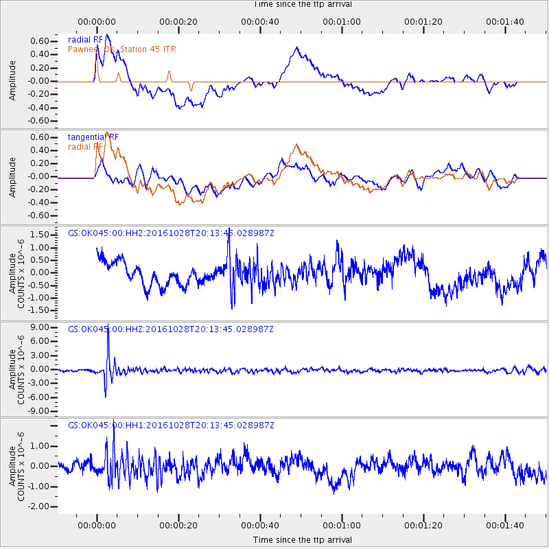
OK045 Pawnee, OK, Station 45 - Earthquake Result Viewer
*The percent match for this event was below the threshold and hence no stack was calculated.
| Earthquake location: |
Tyrrhenian Sea |
| Earthquake latitude/longitude: |
39.3/13.5 |
| Earthquake time(UTC): |
2016/10/28 (302) 20:02:48 GMT |
| Earthquake Depth: |
448 km |
| Earthquake Magnitude: |
5.8 MWW, 5.8 MWB |
| Earthquake Catalog/Contributor: |
NEIC PDE/NEIC COMCAT |
|
| Network: |
GS US Geological Survey Networks |
| Station: |
OK045 Pawnee, OK, Station 45 |
| Lat/Lon: |
36.45 N/96.92 W |
| Elevation: |
284 m |
|
| Distance: |
81.1 deg |
| Az: |
310.126 deg |
| Baz: |
47.364 deg |
| Ray Param: |
$rayparam |
*The percent match for this event was below the threshold and hence was not used in the summary stack. |
|
| Radial Match: |
71.76307 % |
| Radial Bump: |
400 |
| Transverse Match: |
56.81939 % |
| Transverse Bump: |
400 |
| SOD ConfigId: |
1815711 |
| Insert Time: |
2016-11-11 20:07:04.299 +0000 |
| GWidth: |
2.5 |
| Max Bumps: |
400 |
| Tol: |
0.001 |
|
Signal To Noise
| Channel | StoN | STA | LTA |
| GS:OK045:00:HHZ:20161028T20:13:45.028987Z | 15.461424 | 2.7219846E-6 | 1.7605007E-7 |
| GS:OK045:00:HH1:20161028T20:13:45.028987Z | 2.453776 | 6.539432E-7 | 2.6650486E-7 |
| GS:OK045:00:HH2:20161028T20:13:45.028987Z | 1.5129818 | 6.984711E-7 | 4.6165206E-7 |
| Arrivals |
| Ps | |
| PpPs | |
| PsPs/PpSs | |


