You are here: Home > Network List > GS - US Geological Survey Networks Stations List
> Station OK051 E0350 and S34600 Roads, Ralston, OK > Earthquake Result Viewer
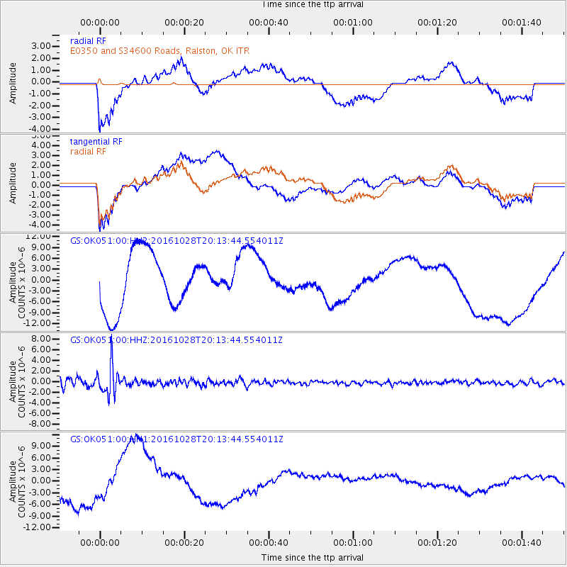
OK051 E0350 and S34600 Roads, Ralston, OK - Earthquake Result Viewer
*The percent match for this event was below the threshold and hence no stack was calculated.
| Earthquake location: |
Tyrrhenian Sea |
| Earthquake latitude/longitude: |
39.3/13.5 |
| Earthquake time(UTC): |
2016/10/28 (302) 20:02:48 GMT |
| Earthquake Depth: |
448 km |
| Earthquake Magnitude: |
5.8 MWW, 5.8 MWB |
| Earthquake Catalog/Contributor: |
NEIC PDE/NEIC COMCAT |
|
| Network: |
GS US Geological Survey Networks |
| Station: |
OK051 E0350 and S34600 Roads, Ralston, OK |
| Lat/Lon: |
36.51 N/96.84 W |
| Elevation: |
263 m |
|
| Distance: |
81.0 deg |
| Az: |
310.12 deg |
| Baz: |
47.416 deg |
| Ray Param: |
$rayparam |
*The percent match for this event was below the threshold and hence was not used in the summary stack. |
|
| Radial Match: |
50.55127 % |
| Radial Bump: |
400 |
| Transverse Match: |
54.489002 % |
| Transverse Bump: |
400 |
| SOD ConfigId: |
1815711 |
| Insert Time: |
2016-11-11 20:07:17.866 +0000 |
| GWidth: |
2.5 |
| Max Bumps: |
400 |
| Tol: |
0.001 |
|
Signal To Noise
| Channel | StoN | STA | LTA |
| GS:OK051:00:HHZ:20161028T20:13:44.554011Z | 3.9608757 | 2.7387462E-6 | 6.9144966E-7 |
| GS:OK051:00:HH1:20161028T20:13:44.554011Z | 1.0878602 | 3.3723165E-6 | 3.0999538E-6 |
| GS:OK051:00:HH2:20161028T20:13:44.554011Z | 0.7627776 | 5.8744567E-6 | 7.701401E-6 |
| Arrivals |
| Ps | |
| PpPs | |
| PsPs/PpSs | |


