You are here: Home > Network List > TA - USArray Transportable Network (new EarthScope stations) Stations List
> Station K05A Summer Lake, OR, USA > Earthquake Result Viewer
K05A Summer Lake, OR, USA - Earthquake Result Viewer

| Earthquake location: |
Southeast Of Loyalty Islands |
| Earthquake latitude/longitude: |
-21.5/170.9 |
| Earthquake time(UTC): |
2007/07/27 (208) 14:46:26 GMT |
| Earthquake Depth: |
10 km |
| Earthquake Magnitude: |
6.0 MB, 6.0 MS, 6.1 MW, 6.1 MW |
| Earthquake Catalog/Contributor: |
WHDF/NEIC |
|
| Network: |
TA USArray Transportable Network (new EarthScope stations) |
| Station: |
K05A Summer Lake, OR, USA |
| Lat/Lon: |
42.73 N/120.89 W |
| Elevation: |
1887 m |
|
| Distance: |
89.5 deg |
| Az: |
43.161 deg |
| Baz: |
239.853 deg |
| Ray Param: |
0.041832652 |
| Estimated Moho Depth: |
12.25 km |
| Estimated Crust Vp/Vs: |
1.63 |
| Assumed Crust Vp: |
6.597 km/s |
| Estimated Crust Vs: |
4.054 km/s |
| Estimated Crust Poisson's Ratio: |
0.20 |
|
| Radial Match: |
84.00016 % |
| Radial Bump: |
400 |
| Transverse Match: |
81.25854 % |
| Transverse Bump: |
400 |
| SOD ConfigId: |
2564 |
| Insert Time: |
2010-03-06 22:15:25.176 +0000 |
| GWidth: |
2.5 |
| Max Bumps: |
400 |
| Tol: |
0.001 |
|
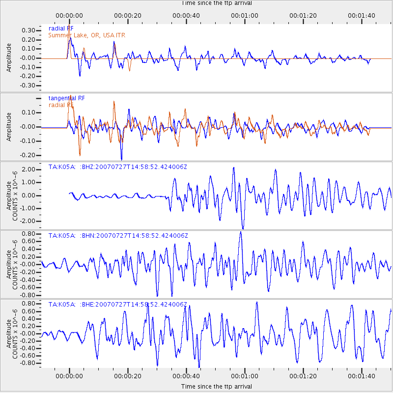
Signal To Noise
| Channel | StoN | STA | LTA |
| TA:K05A: :BHN:20070727T14:58:52.424006Z | 1.2702119 | 7.934234E-8 | 6.246386E-8 |
| TA:K05A: :BHE:20070727T14:58:52.424006Z | 0.9276705 | 1.1167119E-7 | 1.2037808E-7 |
| TA:K05A: :BHZ:20070727T14:58:52.424006Z | 2.6952646 | 3.2318025E-7 | 1.1990669E-7 |
| Arrivals |
| Ps | 1.2 SECOND |
| PpPs | 4.8 SECOND |
| PsPs/PpSs | 6.0 SECOND |


