You are here: Home > Network List > IW - Intermountain West Stations List
> Station MOOW Moose Ponds, Wyoming, USA > Earthquake Result Viewer
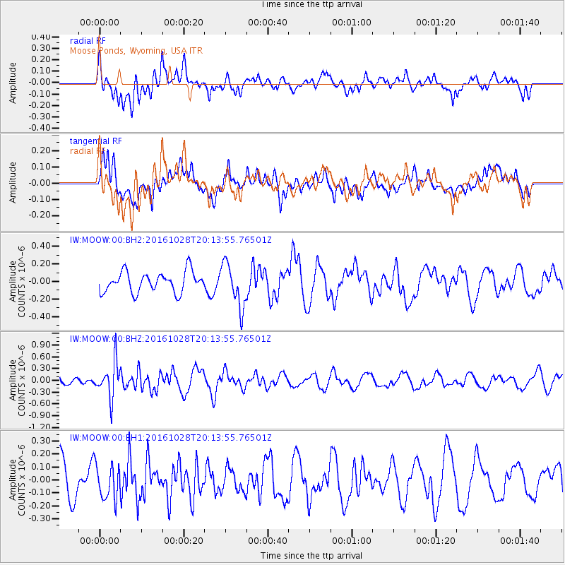
MOOW Moose Ponds, Wyoming, USA - Earthquake Result Viewer
*The percent match for this event was below the threshold and hence no stack was calculated.
| Earthquake location: |
Tyrrhenian Sea |
| Earthquake latitude/longitude: |
39.3/13.5 |
| Earthquake time(UTC): |
2016/10/28 (302) 20:02:48 GMT |
| Earthquake Depth: |
448 km |
| Earthquake Magnitude: |
5.8 MWW, 5.8 MWB |
| Earthquake Catalog/Contributor: |
NEIC PDE/NEIC COMCAT |
|
| Network: |
IW Intermountain West |
| Station: |
MOOW Moose Ponds, Wyoming, USA |
| Lat/Lon: |
43.75 N/110.74 W |
| Elevation: |
2128 m |
|
| Distance: |
83.2 deg |
| Az: |
322.913 deg |
| Baz: |
40.206 deg |
| Ray Param: |
$rayparam |
*The percent match for this event was below the threshold and hence was not used in the summary stack. |
|
| Radial Match: |
46.07863 % |
| Radial Bump: |
400 |
| Transverse Match: |
46.172146 % |
| Transverse Bump: |
400 |
| SOD ConfigId: |
1815711 |
| Insert Time: |
2016-11-11 20:09:44.816 +0000 |
| GWidth: |
2.5 |
| Max Bumps: |
400 |
| Tol: |
0.001 |
|
Signal To Noise
| Channel | StoN | STA | LTA |
| IW:MOOW:00:BHZ:20161028T20:13:55.76501Z | 5.115173 | 4.6012835E-7 | 8.995363E-8 |
| IW:MOOW:00:BH1:20161028T20:13:55.76501Z | 0.9403799 | 1.2374895E-7 | 1.3159463E-7 |
| IW:MOOW:00:BH2:20161028T20:13:55.76501Z | 2.200292 | 2.5452704E-7 | 1.15678745E-7 |
| Arrivals |
| Ps | |
| PpPs | |
| PsPs/PpSs | |


