You are here: Home > Network List > IW - Intermountain West Stations List
> Station PLID Pearl Lake, Idaho, USA > Earthquake Result Viewer
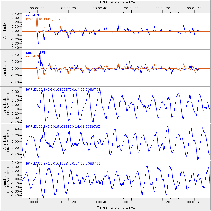
PLID Pearl Lake, Idaho, USA - Earthquake Result Viewer
*The percent match for this event was below the threshold and hence no stack was calculated.
| Earthquake location: |
Tyrrhenian Sea |
| Earthquake latitude/longitude: |
39.3/13.5 |
| Earthquake time(UTC): |
2016/10/28 (302) 20:02:48 GMT |
| Earthquake Depth: |
448 km |
| Earthquake Magnitude: |
5.8 MWW, 5.8 MWB |
| Earthquake Catalog/Contributor: |
NEIC PDE/NEIC COMCAT |
|
| Network: |
IW Intermountain West |
| Station: |
PLID Pearl Lake, Idaho, USA |
| Lat/Lon: |
45.09 N/116.00 W |
| Elevation: |
2164 m |
|
| Distance: |
84.5 deg |
| Az: |
326.712 deg |
| Baz: |
36.945 deg |
| Ray Param: |
$rayparam |
*The percent match for this event was below the threshold and hence was not used in the summary stack. |
|
| Radial Match: |
52.340015 % |
| Radial Bump: |
400 |
| Transverse Match: |
75.57123 % |
| Transverse Bump: |
351 |
| SOD ConfigId: |
1815711 |
| Insert Time: |
2016-11-11 20:09:47.792 +0000 |
| GWidth: |
2.5 |
| Max Bumps: |
400 |
| Tol: |
0.001 |
|
Signal To Noise
| Channel | StoN | STA | LTA |
| IW:PLID:00:BHZ:20161028T20:14:02.208979Z | 0.6875482 | 2.630297E-7 | 3.8256184E-7 |
| IW:PLID:00:BH1:20161028T20:14:02.208979Z | 2.8205748 | 2.9041863E-7 | 1.0296434E-7 |
| IW:PLID:00:BH2:20161028T20:14:02.208979Z | 0.7274669 | 1.739429E-7 | 2.3910764E-7 |
| Arrivals |
| Ps | |
| PpPs | |
| PsPs/PpSs | |


