You are here: Home > Network List > TA - USArray Transportable Network (new EarthScope stations) Stations List
> Station TOLK Toolik Lake Research Station, AK, USA > Earthquake Result Viewer
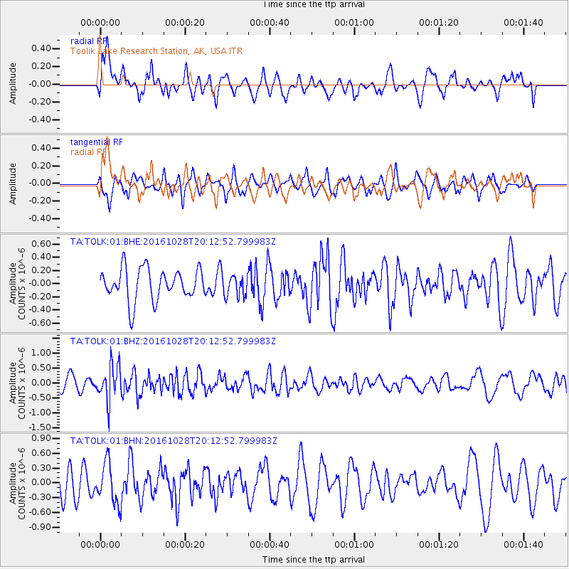
TOLK Toolik Lake Research Station, AK, USA - Earthquake Result Viewer
*The percent match for this event was below the threshold and hence no stack was calculated.
| Earthquake location: |
Tyrrhenian Sea |
| Earthquake latitude/longitude: |
39.3/13.5 |
| Earthquake time(UTC): |
2016/10/28 (302) 20:02:48 GMT |
| Earthquake Depth: |
448 km |
| Earthquake Magnitude: |
5.8 MWW, 5.8 MWB |
| Earthquake Catalog/Contributor: |
NEIC PDE/NEIC COMCAT |
|
| Network: |
TA USArray Transportable Network (new EarthScope stations) |
| Station: |
TOLK Toolik Lake Research Station, AK, USA |
| Lat/Lon: |
68.64 N/149.57 W |
| Elevation: |
760 m |
|
| Distance: |
71.6 deg |
| Az: |
353.56 deg |
| Baz: |
13.74 deg |
| Ray Param: |
$rayparam |
*The percent match for this event was below the threshold and hence was not used in the summary stack. |
|
| Radial Match: |
56.913765 % |
| Radial Bump: |
400 |
| Transverse Match: |
55.401302 % |
| Transverse Bump: |
400 |
| SOD ConfigId: |
1815711 |
| Insert Time: |
2016-11-11 20:11:35.630 +0000 |
| GWidth: |
2.5 |
| Max Bumps: |
400 |
| Tol: |
0.001 |
|
Signal To Noise
| Channel | StoN | STA | LTA |
| TA:TOLK:01:BHZ:20161028T20:12:52.799983Z | 2.0035167 | 6.03772E-7 | 3.0135612E-7 |
| TA:TOLK:01:BHN:20161028T20:12:52.799983Z | 1.2940915 | 4.2909414E-7 | 3.3157943E-7 |
| TA:TOLK:01:BHE:20161028T20:12:52.799983Z | 0.6670354 | 1.6048132E-7 | 2.4058892E-7 |
| Arrivals |
| Ps | |
| PpPs | |
| PsPs/PpSs | |


