You are here: Home > Network List > US - United States National Seismic Network Stations List
> Station MSO Missoula, Montana, USA > Earthquake Result Viewer
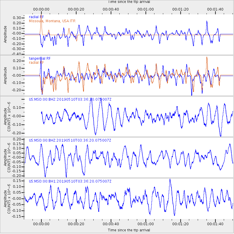
MSO Missoula, Montana, USA - Earthquake Result Viewer
*The percent match for this event was below the threshold and hence no stack was calculated.
| Earthquake location: |
Kermadec Islands Region |
| Earthquake latitude/longitude: |
-28.7/-176.8 |
| Earthquake time(UTC): |
2019/05/10 (130) 03:23:33 GMT |
| Earthquake Depth: |
10 km |
| Earthquake Magnitude: |
5.6 Mww |
| Earthquake Catalog/Contributor: |
NEIC PDE/us |
|
| Network: |
US United States National Seismic Network |
| Station: |
MSO Missoula, Montana, USA |
| Lat/Lon: |
46.83 N/113.94 W |
| Elevation: |
1264 m |
|
| Distance: |
94.1 deg |
| Az: |
37.763 deg |
| Baz: |
231.594 deg |
| Ray Param: |
$rayparam |
*The percent match for this event was below the threshold and hence was not used in the summary stack. |
|
| Radial Match: |
64.15544 % |
| Radial Bump: |
400 |
| Transverse Match: |
46.672974 % |
| Transverse Bump: |
400 |
| SOD ConfigId: |
18369291 |
| Insert Time: |
2019-05-24 03:28:19.191 +0000 |
| GWidth: |
2.5 |
| Max Bumps: |
400 |
| Tol: |
0.001 |
|
Signal To Noise
| Channel | StoN | STA | LTA |
| US:MSO:00:BHZ:20190510T03:36:20.075007Z | 1.6201972 | 1.097752E-7 | 6.775422E-8 |
| US:MSO:00:BH1:20190510T03:36:20.075007Z | 0.9869607 | 5.0185516E-8 | 5.0848545E-8 |
| US:MSO:00:BH2:20190510T03:36:20.075007Z | 3.647077 | 1.4629417E-7 | 4.0112717E-8 |
| Arrivals |
| Ps | |
| PpPs | |
| PsPs/PpSs | |


