
GLA Glamis, California, USA - Earthquake Result Viewer
| ||||||||||||||||||
| ||||||||||||||||||
| ||||||||||||||||||
|
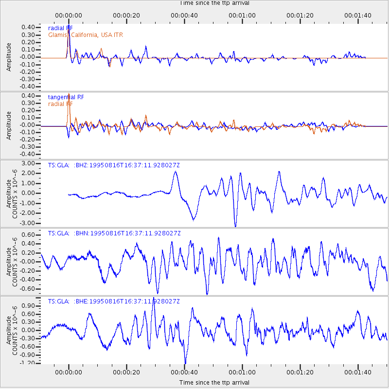
Signal To Noise
| Channel | StoN | STA | LTA |
| TS:GLA: :BHN:19950816T16:37:11.928027Z | 1.4970773 | 1.8638033E-7 | 1.2449614E-7 |
| TS:GLA: :BHE:19950816T16:37:11.928027Z | 0.9477786 | 1.5227072E-7 | 1.6066063E-7 |
| TS:GLA: :BHZ:19950816T16:37:11.928027Z | 1.6605705 | 3.0797716E-7 | 1.8546467E-7 |
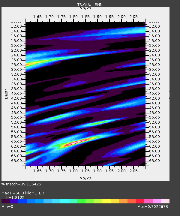
| Arrivals | |
| Ps | 8.1 SECOND |
| PpPs | 27 SECOND |
| PsPs/PpSs | 35 SECOND |

