You are here: Home > Network List > TA - USArray Transportable Network (new EarthScope stations) Stations List
> Station D16A Dana Ranch, Cascade, MT, USA > Earthquake Result Viewer
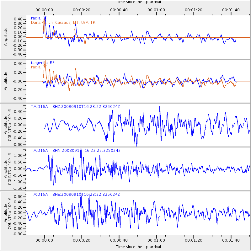
D16A Dana Ranch, Cascade, MT, USA - Earthquake Result Viewer
*The percent match for this event was below the threshold and hence no stack was calculated.
| Earthquake location: |
Northern Chile |
| Earthquake latitude/longitude: |
-20.3/-69.2 |
| Earthquake time(UTC): |
2008/09/10 (254) 16:12:04 GMT |
| Earthquake Depth: |
38 km |
| Earthquake Magnitude: |
5.6 MB, 5.3 MS |
| Earthquake Catalog/Contributor: |
WHDF/NEIC |
|
| Network: |
TA USArray Transportable Network (new EarthScope stations) |
| Station: |
D16A Dana Ranch, Cascade, MT, USA |
| Lat/Lon: |
47.03 N/111.55 W |
| Elevation: |
1427 m |
|
| Distance: |
77.1 deg |
| Az: |
331.798 deg |
| Baz: |
139.563 deg |
| Ray Param: |
$rayparam |
*The percent match for this event was below the threshold and hence was not used in the summary stack. |
|
| Radial Match: |
71.60081 % |
| Radial Bump: |
400 |
| Transverse Match: |
60.445316 % |
| Transverse Bump: |
400 |
| SOD ConfigId: |
2560 |
| Insert Time: |
2010-03-06 22:19:11.063 +0000 |
| GWidth: |
2.5 |
| Max Bumps: |
400 |
| Tol: |
0.001 |
|
Signal To Noise
| Channel | StoN | STA | LTA |
| TA:D16A: :BHN:20080910T16:23:22.325024Z | 5.115509 | 5.1521585E-7 | 1.00716434E-7 |
| TA:D16A: :BHE:20080910T16:23:22.325024Z | 1.0920253 | 1.3096607E-7 | 1.1992952E-7 |
| TA:D16A: :BHZ:20080910T16:23:22.325024Z | 2.008234 | 2.1381844E-7 | 1.06470885E-7 |
| Arrivals |
| Ps | |
| PpPs | |
| PsPs/PpSs | |


