You are here: Home > Network List > TA - USArray Transportable Network (new EarthScope stations) Stations List
> Station D16A Dana Ranch, Cascade, MT, USA > Earthquake Result Viewer
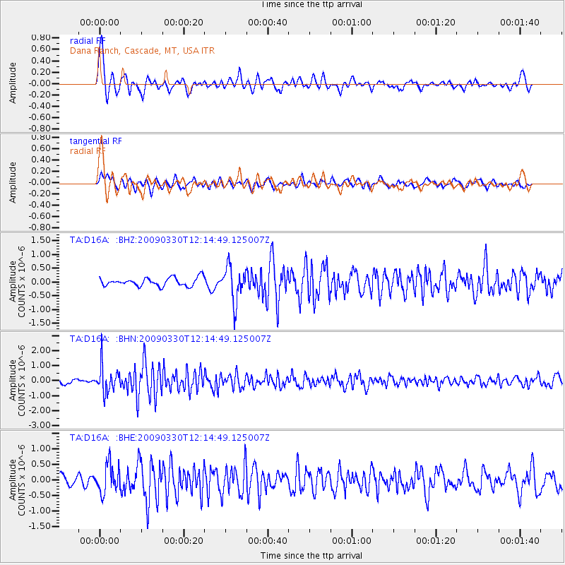
D16A Dana Ranch, Cascade, MT, USA - Earthquake Result Viewer
*The percent match for this event was below the threshold and hence no stack was calculated.
| Earthquake location: |
Andreanof Islands, Aleutian Is. |
| Earthquake latitude/longitude: |
51.5/-178.3 |
| Earthquake time(UTC): |
2009/03/30 (089) 12:07:28 GMT |
| Earthquake Depth: |
31 km |
| Earthquake Magnitude: |
6.0 MB, 5.5 MS, 5.7 MW, 5.7 MW |
| Earthquake Catalog/Contributor: |
WHDF/NEIC |
|
| Network: |
TA USArray Transportable Network (new EarthScope stations) |
| Station: |
D16A Dana Ranch, Cascade, MT, USA |
| Lat/Lon: |
47.03 N/111.55 W |
| Elevation: |
1427 m |
|
| Distance: |
42.4 deg |
| Az: |
68.747 deg |
| Baz: |
301.681 deg |
| Ray Param: |
$rayparam |
*The percent match for this event was below the threshold and hence was not used in the summary stack. |
|
| Radial Match: |
76.58592 % |
| Radial Bump: |
400 |
| Transverse Match: |
66.88002 % |
| Transverse Bump: |
400 |
| SOD ConfigId: |
2658 |
| Insert Time: |
2010-03-06 22:19:53.143 +0000 |
| GWidth: |
2.5 |
| Max Bumps: |
400 |
| Tol: |
0.001 |
|
Signal To Noise
| Channel | StoN | STA | LTA |
| TA:D16A: :BHN:20090330T12:14:49.125007Z | 6.5593247 | 8.9395326E-7 | 1.362874E-7 |
| TA:D16A: :BHE:20090330T12:14:49.125007Z | 2.9976285 | 4.7177488E-7 | 1.573827E-7 |
| TA:D16A: :BHZ:20090330T12:14:49.125007Z | 4.2962685 | 6.4470726E-7 | 1.5006215E-7 |
| Arrivals |
| Ps | |
| PpPs | |
| PsPs/PpSs | |


