You are here: Home > Network List > US - United States National Seismic Network Stations List
> Station HDIL Hopedale, Illinois, USA > Earthquake Result Viewer
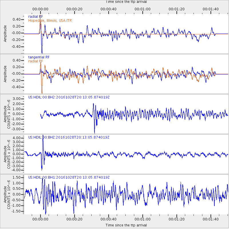
HDIL Hopedale, Illinois, USA - Earthquake Result Viewer
*The percent match for this event was below the threshold and hence no stack was calculated.
| Earthquake location: |
Tyrrhenian Sea |
| Earthquake latitude/longitude: |
39.3/13.5 |
| Earthquake time(UTC): |
2016/10/28 (302) 20:02:48 GMT |
| Earthquake Depth: |
448 km |
| Earthquake Magnitude: |
5.8 MWW, 5.8 MWB |
| Earthquake Catalog/Contributor: |
NEIC PDE/NEIC COMCAT |
|
| Network: |
US United States National Seismic Network |
| Station: |
HDIL Hopedale, Illinois, USA |
| Lat/Lon: |
40.56 N/89.29 W |
| Elevation: |
219 m |
|
| Distance: |
73.9 deg |
| Az: |
309.353 deg |
| Baz: |
51.935 deg |
| Ray Param: |
$rayparam |
*The percent match for this event was below the threshold and hence was not used in the summary stack. |
|
| Radial Match: |
64.69419 % |
| Radial Bump: |
400 |
| Transverse Match: |
70.12386 % |
| Transverse Bump: |
400 |
| SOD ConfigId: |
1815711 |
| Insert Time: |
2016-11-11 20:12:22.461 +0000 |
| GWidth: |
2.5 |
| Max Bumps: |
400 |
| Tol: |
0.001 |
|
Signal To Noise
| Channel | StoN | STA | LTA |
| US:HDIL:00:BHZ:20161028T20:13:05.874019Z | 4.659731 | 1.6720985E-6 | 3.588401E-7 |
| US:HDIL:00:BH1:20161028T20:13:05.874019Z | 2.6644967 | 8.7629564E-7 | 3.2887849E-7 |
| US:HDIL:00:BH2:20161028T20:13:05.874019Z | 4.263946 | 1.1883179E-6 | 2.7868973E-7 |
| Arrivals |
| Ps | |
| PpPs | |
| PsPs/PpSs | |


