GLA Glamis, California, USA - Earthquake Result Viewer
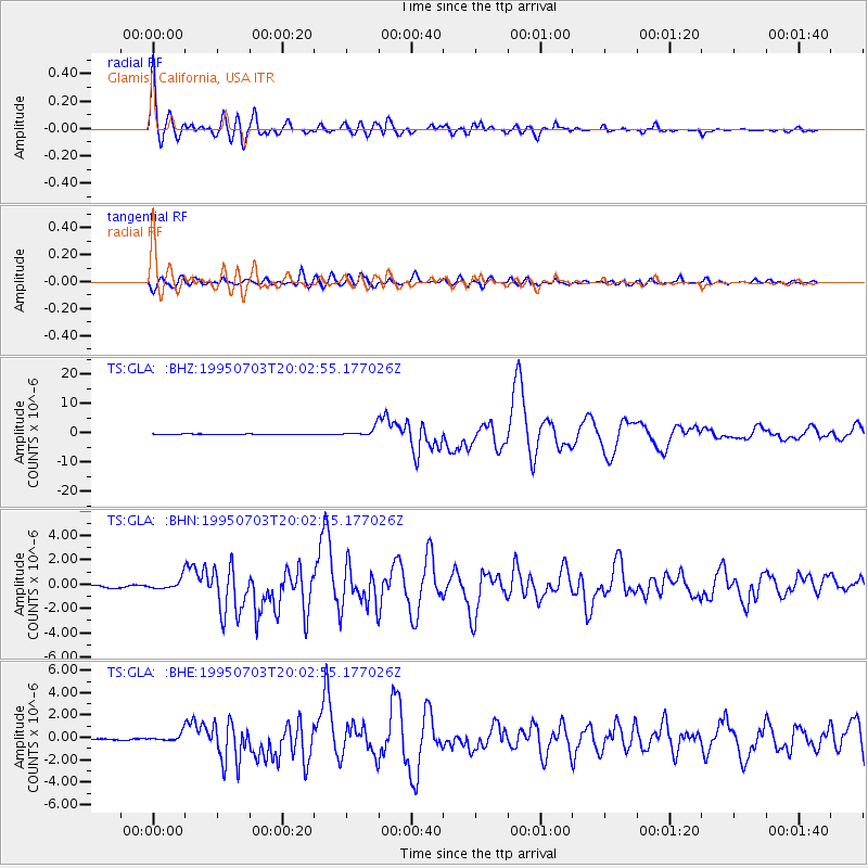
Earthquake location: Kermadec Islands, New Zealand
Earthquake latitude/longitude: -29.2/-177.6
Earthquake time(UTC): 1995/07/03 (184) 19:50:50 GMT
Earthquake Depth: 33 km
Earthquake Magnitude: 6.5 MB, 7.2 MS, 7.2 UNKNOWN, 7.2 MW
Earthquake Catalog/Contributor: WHDF/NEIC
Network: TS TERRAscope (Southern California Seismic Network)
Station: GLA Glamis, California, USA
Lat/Lon: 33.05 N/114.83 W
Elevation: 627 m
Distance: 85.9 deg
Az: 48.489 deg
Baz: 231.222 deg
Ray Param: 0.044426735
Estimated Moho Depth: 26.75 km
Estimated Crust Vp/Vs: 1.64
Assumed Crust Vp: 6.155 km/s
Estimated Crust Vs: 3.747 km/s
Estimated Crust Poisson's Ratio: 0.21
Radial Match: 97.97904 %
Radial Bump: 400
Transverse Match: 93.14475 %
Transverse Bump: 400
SOD ConfigId: 6273
Insert Time: 2010-02-26 14:12:15.380 +0000
GWidth: 2.5
Max Bumps: 400
Tol: 0.001

Signal To Noise

ChannelStoNSTALTA
TS:GLA: :BHN:19950703T20:02:55.177026Z3.50330074.0957036E-71.1690986E-7
TS:GLA: :BHE:19950703T20:02:55.177026Z6.1188573.3331048E-75.447267E-8
TS:GLA: :BHZ:19950703T20:02:55.177026Z18.5823481.4216511E-67.6505465E-8
Arrivals
Ps2.9 SECOND
PpPs11 SECOND
PsPs/PpSs14 SECOND