You are here: Home > Network List > US - United States National Seismic Network Stations List
> Station HAWA Hanford, Washington, USA > Earthquake Result Viewer
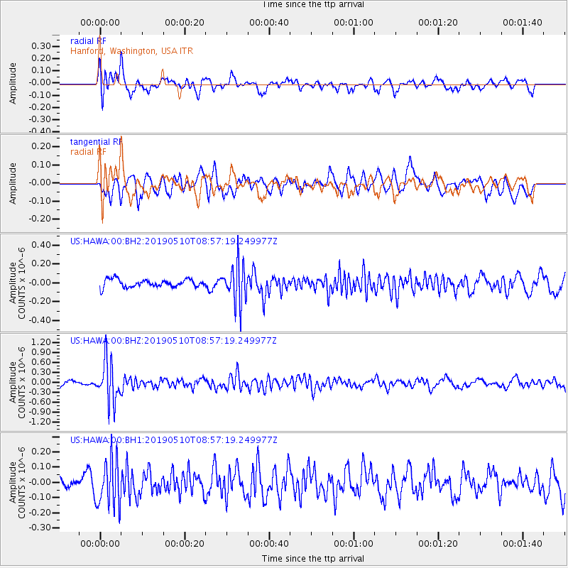
HAWA Hanford, Washington, USA - Earthquake Result Viewer
*The percent match for this event was below the threshold and hence no stack was calculated.
| Earthquake location: |
Vanuatu Islands |
| Earthquake latitude/longitude: |
-19.8/169.1 |
| Earthquake time(UTC): |
2019/05/10 (130) 08:44:54 GMT |
| Earthquake Depth: |
111 km |
| Earthquake Magnitude: |
5.8 Mww |
| Earthquake Catalog/Contributor: |
NEIC PDE/us |
|
| Network: |
US United States National Seismic Network |
| Station: |
HAWA Hanford, Washington, USA |
| Lat/Lon: |
46.39 N/119.53 W |
| Elevation: |
364 m |
|
| Distance: |
92.0 deg |
| Az: |
41.019 deg |
| Baz: |
243.268 deg |
| Ray Param: |
$rayparam |
*The percent match for this event was below the threshold and hence was not used in the summary stack. |
|
| Radial Match: |
75.51581 % |
| Radial Bump: |
400 |
| Transverse Match: |
59.719227 % |
| Transverse Bump: |
400 |
| SOD ConfigId: |
18369291 |
| Insert Time: |
2019-05-24 08:50:47.644 +0000 |
| GWidth: |
2.5 |
| Max Bumps: |
400 |
| Tol: |
0.001 |
|
Signal To Noise
| Channel | StoN | STA | LTA |
| US:HAWA:00:BHZ:20190510T08:57:19.249977Z | 6.683944 | 6.2993837E-7 | 9.42465E-8 |
| US:HAWA:00:BH1:20190510T08:57:19.249977Z | 2.6349638 | 1.5575364E-7 | 5.9110352E-8 |
| US:HAWA:00:BH2:20190510T08:57:19.249977Z | 5.2221622 | 2.149388E-7 | 4.1158966E-8 |
| Arrivals |
| Ps | |
| PpPs | |
| PsPs/PpSs | |


