You are here: Home > Network List > UW - Pacific Northwest Regional Seismic Network Stations List
> Station LEBA Lebam, WA, USA > Earthquake Result Viewer
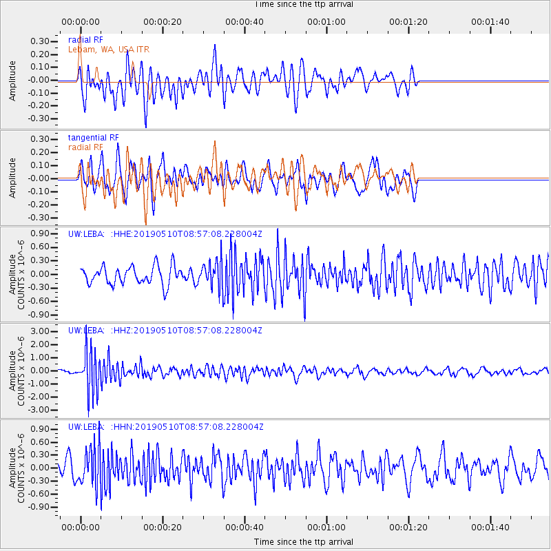
LEBA Lebam, WA, USA - Earthquake Result Viewer
*The percent match for this event was below the threshold and hence no stack was calculated.
| Earthquake location: |
Vanuatu Islands |
| Earthquake latitude/longitude: |
-19.8/169.1 |
| Earthquake time(UTC): |
2019/05/10 (130) 08:44:54 GMT |
| Earthquake Depth: |
111 km |
| Earthquake Magnitude: |
5.8 Mww |
| Earthquake Catalog/Contributor: |
NEIC PDE/us |
|
| Network: |
UW Pacific Northwest Regional Seismic Network |
| Station: |
LEBA Lebam, WA, USA |
| Lat/Lon: |
46.55 N/123.56 W |
| Elevation: |
73 m |
|
| Distance: |
89.6 deg |
| Az: |
39.568 deg |
| Baz: |
240.375 deg |
| Ray Param: |
$rayparam |
*The percent match for this event was below the threshold and hence was not used in the summary stack. |
|
| Radial Match: |
60.147606 % |
| Radial Bump: |
400 |
| Transverse Match: |
64.983406 % |
| Transverse Bump: |
400 |
| SOD ConfigId: |
18369291 |
| Insert Time: |
2019-05-24 08:51:17.423 +0000 |
| GWidth: |
2.5 |
| Max Bumps: |
400 |
| Tol: |
0.001 |
|
Signal To Noise
| Channel | StoN | STA | LTA |
| UW:LEBA: :HHZ:20190510T08:57:08.228004Z | 8.733978 | 1.5289627E-6 | 1.7505914E-7 |
| UW:LEBA: :HHN:20190510T08:57:08.228004Z | 2.1652298 | 4.3913866E-7 | 2.028139E-7 |
| UW:LEBA: :HHE:20190510T08:57:08.228004Z | 1.4787849 | 2.9374425E-7 | 1.9863893E-7 |
| Arrivals |
| Ps | |
| PpPs | |
| PsPs/PpSs | |


