You are here: Home > Network List > TA - USArray Transportable Network (new EarthScope stations) Stations List
> Station M11K Mekoryuk, AK, USA > Earthquake Result Viewer
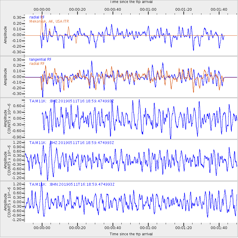
M11K Mekoryuk, AK, USA - Earthquake Result Viewer
*The percent match for this event was below the threshold and hence no stack was calculated.
| Earthquake location: |
South Of Kermadec Islands |
| Earthquake latitude/longitude: |
-34.6/180.0 |
| Earthquake time(UTC): |
2019/05/11 (131) 16:06:14 GMT |
| Earthquake Depth: |
73 km |
| Earthquake Magnitude: |
5.4 Mww |
| Earthquake Catalog/Contributor: |
NEIC PDE/us |
|
| Network: |
TA USArray Transportable Network (new EarthScope stations) |
| Station: |
M11K Mekoryuk, AK, USA |
| Lat/Lon: |
60.38 N/166.20 W |
| Elevation: |
3.0 m |
|
| Distance: |
95.3 deg |
| Az: |
6.838 deg |
| Baz: |
191.408 deg |
| Ray Param: |
$rayparam |
*The percent match for this event was below the threshold and hence was not used in the summary stack. |
|
| Radial Match: |
53.705284 % |
| Radial Bump: |
400 |
| Transverse Match: |
55.84394 % |
| Transverse Bump: |
400 |
| SOD ConfigId: |
18369291 |
| Insert Time: |
2019-05-25 16:09:14.850 +0000 |
| GWidth: |
2.5 |
| Max Bumps: |
400 |
| Tol: |
0.001 |
|
Signal To Noise
| Channel | StoN | STA | LTA |
| TA:M11K: :BHZ:20190511T16:18:59.474993Z | 2.9524076 | 7.7136156E-7 | 2.6126526E-7 |
| TA:M11K: :BHN:20190511T16:18:59.474993Z | 1.9072099 | 6.2247847E-7 | 3.2638175E-7 |
| TA:M11K: :BHE:20190511T16:18:59.474993Z | 0.9644556 | 3.3134322E-7 | 3.4355463E-7 |
| Arrivals |
| Ps | |
| PpPs | |
| PsPs/PpSs | |


