You are here: Home > Network List > US - United States National Seismic Network Stations List
> Station HAWA Hanford, Washington, USA > Earthquake Result Viewer
HAWA Hanford, Washington, USA - Earthquake Result Viewer
*The percent match for this event was below the threshold and hence no stack was calculated.
| Earthquake location: |
Panama-Costa Rica Border Region |
| Earthquake latitude/longitude: |
8.6/-82.8 |
| Earthquake time(UTC): |
2019/05/12 (132) 19:24:50 GMT |
| Earthquake Depth: |
19 km |
| Earthquake Magnitude: |
6.1 Mww |
| Earthquake Catalog/Contributor: |
NEIC PDE/us |
|
| Network: |
US United States National Seismic Network |
| Station: |
HAWA Hanford, Washington, USA |
| Lat/Lon: |
46.39 N/119.53 W |
| Elevation: |
364 m |
|
| Distance: |
49.0 deg |
| Az: |
326.766 deg |
| Baz: |
128.462 deg |
| Ray Param: |
$rayparam |
*The percent match for this event was below the threshold and hence was not used in the summary stack. |
|
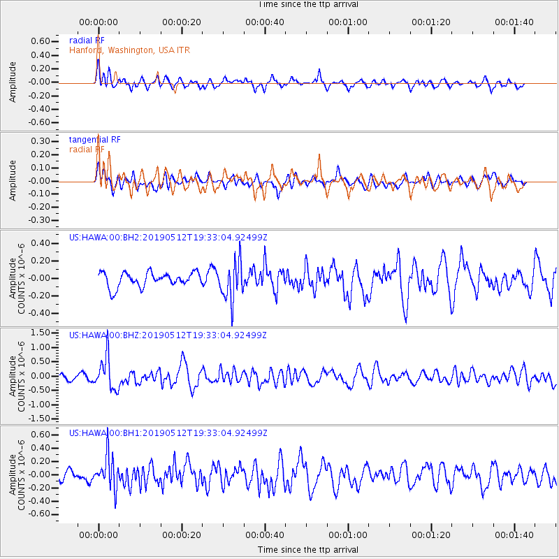
| Radial Match: |
65.56709 % |
| Radial Bump: |
400 |
| Transverse Match: |
47.690147 % |
| Transverse Bump: |
400 |
| SOD ConfigId: |
18369291 |
| Insert Time: |
2019-05-26 19:33:40.487 +0000 |
| GWidth: |
2.5 |
| Max Bumps: |
400 |
| Tol: |
0.001 |
|
Signal To Noise
| Channel | StoN | STA | LTA |
| US:HAWA:00:BHZ:20190512T19:33:04.92499Z | 3.5345807 | 5.9403476E-7 | 1.680637E-7 |
| US:HAWA:00:BH1:20190512T19:33:04.92499Z | 2.5262995 | 2.5284E-7 | 1.0008315E-7 |
| US:HAWA:00:BH2:20190512T19:33:04.92499Z | 2.6892333 | 2.2276339E-7 | 8.283528E-8 |
| Arrivals |
| Ps | |
| PpPs | |
| PsPs/PpSs | |


