You are here: Home > Network List > US - United States National Seismic Network Stations List
> Station MSO Missoula, Montana, USA > Earthquake Result Viewer
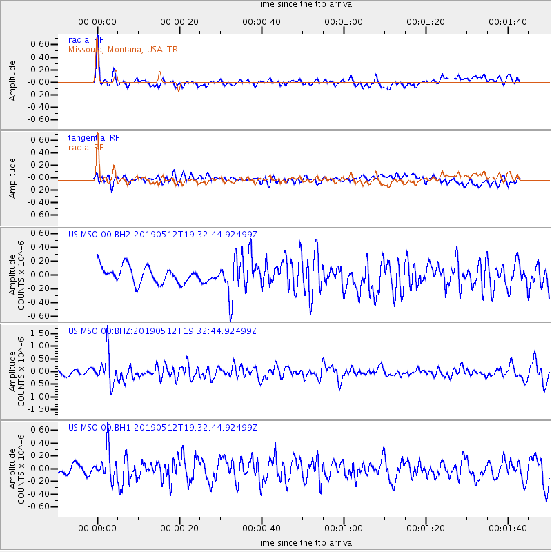
MSO Missoula, Montana, USA - Earthquake Result Viewer
*The percent match for this event was below the threshold and hence no stack was calculated.
| Earthquake location: |
Panama-Costa Rica Border Region |
| Earthquake latitude/longitude: |
8.6/-82.8 |
| Earthquake time(UTC): |
2019/05/12 (132) 19:24:50 GMT |
| Earthquake Depth: |
19 km |
| Earthquake Magnitude: |
6.1 Mww |
| Earthquake Catalog/Contributor: |
NEIC PDE/us |
|
| Network: |
US United States National Seismic Network |
| Station: |
MSO Missoula, Montana, USA |
| Lat/Lon: |
46.83 N/113.94 W |
| Elevation: |
1264 m |
|
| Distance: |
46.4 deg |
| Az: |
330.68 deg |
| Baz: |
135.149 deg |
| Ray Param: |
$rayparam |
*The percent match for this event was below the threshold and hence was not used in the summary stack. |
|
| Radial Match: |
76.02775 % |
| Radial Bump: |
400 |
| Transverse Match: |
49.24062 % |
| Transverse Bump: |
400 |
| SOD ConfigId: |
18369291 |
| Insert Time: |
2019-05-26 19:33:45.170 +0000 |
| GWidth: |
2.5 |
| Max Bumps: |
400 |
| Tol: |
0.001 |
|
Signal To Noise
| Channel | StoN | STA | LTA |
| US:MSO:00:BHZ:20190512T19:32:44.92499Z | 7.3171697 | 6.2272545E-7 | 8.510469E-8 |
| US:MSO:00:BH1:20190512T19:32:44.92499Z | 2.6931558 | 2.3662176E-7 | 8.786041E-8 |
| US:MSO:00:BH2:20190512T19:32:44.92499Z | 2.2948809 | 2.7030225E-7 | 1.1778488E-7 |
| Arrivals |
| Ps | |
| PpPs | |
| PsPs/PpSs | |


