You are here: Home > Network List > TA - USArray Transportable Network (new EarthScope stations) Stations List
> Station G17A Pierce Place, Pray, MT, USA > Earthquake Result Viewer
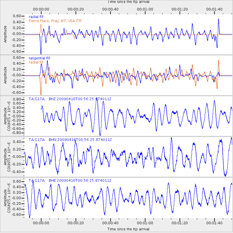
G17A Pierce Place, Pray, MT, USA - Earthquake Result Viewer
*The percent match for this event was below the threshold and hence no stack was calculated.
| Earthquake location: |
Solomon Islands |
| Earthquake latitude/longitude: |
-6.5/154.2 |
| Earthquake time(UTC): |
2009/04/16 (106) 00:43:20 GMT |
| Earthquake Depth: |
10 km |
| Earthquake Magnitude: |
5.8 MS, 5.3 MB, 5.8 MW, 5.7 MW |
| Earthquake Catalog/Contributor: |
WHDF/NEIC |
|
| Network: |
TA USArray Transportable Network (new EarthScope stations) |
| Station: |
G17A Pierce Place, Pray, MT, USA |
| Lat/Lon: |
45.32 N/110.74 W |
| Elevation: |
1574 m |
|
| Distance: |
98.2 deg |
| Az: |
45.227 deg |
| Baz: |
269.049 deg |
| Ray Param: |
$rayparam |
*The percent match for this event was below the threshold and hence was not used in the summary stack. |
|
| Radial Match: |
42.008316 % |
| Radial Bump: |
400 |
| Transverse Match: |
59.143448 % |
| Transverse Bump: |
336 |
| SOD ConfigId: |
2658 |
| Insert Time: |
2010-03-06 22:28:43.579 +0000 |
| GWidth: |
2.5 |
| Max Bumps: |
400 |
| Tol: |
0.001 |
|
Signal To Noise
| Channel | StoN | STA | LTA |
| TA:G17A: :BHN:20090416T00:56:25.874011Z | 0.79381996 | 1.5465456E-7 | 1.9482322E-7 |
| TA:G17A: :BHE:20090416T00:56:25.874011Z | 0.5628517 | 1.7643853E-7 | 3.134725E-7 |
| TA:G17A: :BHZ:20090416T00:56:25.874011Z | 2.041038 | 5.960694E-7 | 2.9204227E-7 |
| Arrivals |
| Ps | |
| PpPs | |
| PsPs/PpSs | |


