
GLA Glamis, California, USA - Earthquake Result Viewer
| ||||||||||||||||||
| ||||||||||||||||||
| ||||||||||||||||||
|
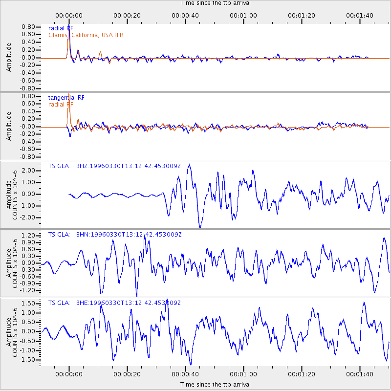
Signal To Noise
| Channel | StoN | STA | LTA |
| TS:GLA: :BHN:19960330T13:12:42.453009Z | 1.108511 | 2.54839E-7 | 2.2989308E-7 |
| TS:GLA: :BHE:19960330T13:12:42.453009Z | 3.4933336 | 3.9559978E-7 | 1.1324421E-7 |
| TS:GLA: :BHZ:19960330T13:12:42.453009Z | 5.8813906 | 7.330388E-7 | 1.2463698E-7 |
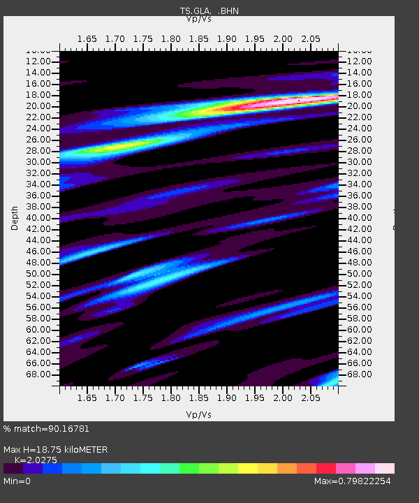
| Arrivals | |
| Ps | 3.3 SECOND |
| PpPs | 8.7 SECOND |
| PsPs/PpSs | 12 SECOND |

