You are here: Home > Network List > TA - USArray Transportable Network (new EarthScope stations) Stations List
> Station E18K Tukpahlearik Creek, AK, USA > Earthquake Result Viewer
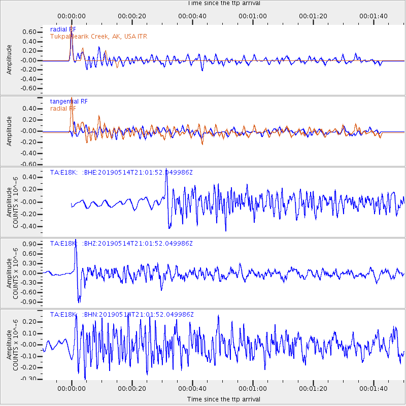
E18K Tukpahlearik Creek, AK, USA - Earthquake Result Viewer
*The percent match for this event was below the threshold and hence no stack was calculated.
| Earthquake location: |
Kuril Islands |
| Earthquake latitude/longitude: |
43.8/147.9 |
| Earthquake time(UTC): |
2019/05/14 (134) 20:55:26 GMT |
| Earthquake Depth: |
36 km |
| Earthquake Magnitude: |
5.2 Mww |
| Earthquake Catalog/Contributor: |
NEIC PDE/us |
|
| Network: |
TA USArray Transportable Network (new EarthScope stations) |
| Station: |
E18K Tukpahlearik Creek, AK, USA |
| Lat/Lon: |
67.42 N/160.60 W |
| Elevation: |
297 m |
|
| Distance: |
35.8 deg |
| Az: |
31.066 deg |
| Baz: |
255.21 deg |
| Ray Param: |
$rayparam |
*The percent match for this event was below the threshold and hence was not used in the summary stack. |
|
| Radial Match: |
77.28454 % |
| Radial Bump: |
400 |
| Transverse Match: |
63.937634 % |
| Transverse Bump: |
400 |
| SOD ConfigId: |
18369291 |
| Insert Time: |
2019-05-28 21:03:16.983 +0000 |
| GWidth: |
2.5 |
| Max Bumps: |
400 |
| Tol: |
0.001 |
|
Signal To Noise
| Channel | StoN | STA | LTA |
| TA:E18K: :BHZ:20190514T21:01:52.049986Z | 9.771795 | 4.6087123E-7 | 4.7163415E-8 |
| TA:E18K: :BHN:20190514T21:01:52.049986Z | 4.6399965 | 1.4881256E-7 | 3.2071696E-8 |
| TA:E18K: :BHE:20190514T21:01:52.049986Z | 5.0672855 | 2.4245008E-7 | 4.7846143E-8 |
| Arrivals |
| Ps | |
| PpPs | |
| PsPs/PpSs | |


