You are here: Home > Network List > TA - USArray Transportable Network (new EarthScope stations) Stations List
> Station H16K Elim, AK, USA > Earthquake Result Viewer
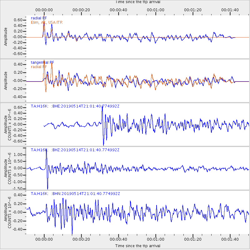
H16K Elim, AK, USA - Earthquake Result Viewer
*The percent match for this event was below the threshold and hence no stack was calculated.
| Earthquake location: |
Kuril Islands |
| Earthquake latitude/longitude: |
43.8/147.9 |
| Earthquake time(UTC): |
2019/05/14 (134) 20:55:26 GMT |
| Earthquake Depth: |
36 km |
| Earthquake Magnitude: |
5.2 Mww |
| Earthquake Catalog/Contributor: |
NEIC PDE/us |
|
| Network: |
TA USArray Transportable Network (new EarthScope stations) |
| Station: |
H16K Elim, AK, USA |
| Lat/Lon: |
64.64 N/162.24 W |
| Elevation: |
216 m |
|
| Distance: |
34.5 deg |
| Az: |
35.507 deg |
| Baz: |
257.348 deg |
| Ray Param: |
$rayparam |
*The percent match for this event was below the threshold and hence was not used in the summary stack. |
|
| Radial Match: |
78.88502 % |
| Radial Bump: |
400 |
| Transverse Match: |
76.39018 % |
| Transverse Bump: |
400 |
| SOD ConfigId: |
18369291 |
| Insert Time: |
2019-05-28 21:03:41.691 +0000 |
| GWidth: |
2.5 |
| Max Bumps: |
400 |
| Tol: |
0.001 |
|
Signal To Noise
| Channel | StoN | STA | LTA |
| TA:H16K: :BHZ:20190514T21:01:40.774992Z | 8.264819 | 5.447594E-7 | 6.591304E-8 |
| TA:H16K: :BHN:20190514T21:01:40.774992Z | 2.0437148 | 1.0599519E-7 | 5.1863985E-8 |
| TA:H16K: :BHE:20190514T21:01:40.774992Z | 6.1998796 | 3.255253E-7 | 5.2505097E-8 |
| Arrivals |
| Ps | |
| PpPs | |
| PsPs/PpSs | |


