You are here: Home > Network List > TA - USArray Transportable Network (new EarthScope stations) Stations List
> Station I17K Unalakleet, AK, USA > Earthquake Result Viewer
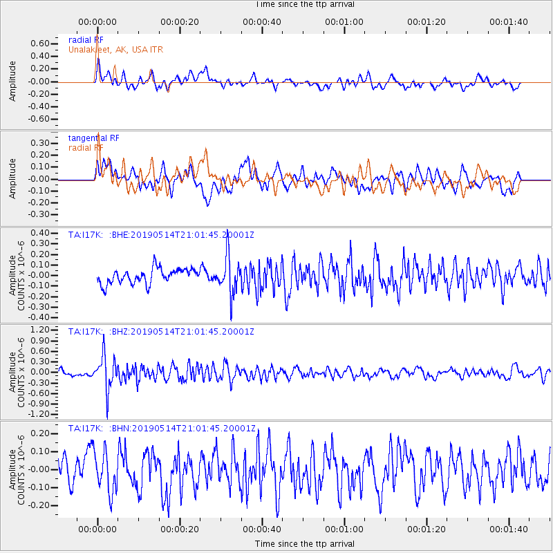
I17K Unalakleet, AK, USA - Earthquake Result Viewer
*The percent match for this event was below the threshold and hence no stack was calculated.
| Earthquake location: |
Kuril Islands |
| Earthquake latitude/longitude: |
43.8/147.9 |
| Earthquake time(UTC): |
2019/05/14 (134) 20:55:26 GMT |
| Earthquake Depth: |
36 km |
| Earthquake Magnitude: |
5.2 Mww |
| Earthquake Catalog/Contributor: |
NEIC PDE/us |
|
| Network: |
TA USArray Transportable Network (new EarthScope stations) |
| Station: |
I17K Unalakleet, AK, USA |
| Lat/Lon: |
63.89 N/160.70 W |
| Elevation: |
105 m |
|
| Distance: |
35.0 deg |
| Az: |
37.037 deg |
| Baz: |
259.994 deg |
| Ray Param: |
$rayparam |
*The percent match for this event was below the threshold and hence was not used in the summary stack. |
|
| Radial Match: |
63.018 % |
| Radial Bump: |
400 |
| Transverse Match: |
57.040276 % |
| Transverse Bump: |
400 |
| SOD ConfigId: |
18369291 |
| Insert Time: |
2019-05-28 21:03:50.707 +0000 |
| GWidth: |
2.5 |
| Max Bumps: |
400 |
| Tol: |
0.001 |
|
Signal To Noise
| Channel | StoN | STA | LTA |
| TA:I17K: :BHZ:20190514T21:01:45.20001Z | 6.706216 | 4.8021104E-7 | 7.160686E-8 |
| TA:I17K: :BHN:20190514T21:01:45.20001Z | 1.1720059 | 1.07094834E-7 | 9.137739E-8 |
| TA:I17K: :BHE:20190514T21:01:45.20001Z | 2.6223826 | 1.8385235E-7 | 7.01089E-8 |
| Arrivals |
| Ps | |
| PpPs | |
| PsPs/PpSs | |


