You are here: Home > Network List > TA - USArray Transportable Network (new EarthScope stations) Stations List
> Station J26L Joseph Creek, AK, USA > Earthquake Result Viewer
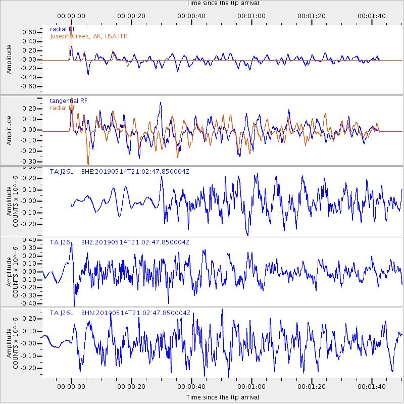
J26L Joseph Creek, AK, USA - Earthquake Result Viewer
*The percent match for this event was below the threshold and hence no stack was calculated.
| Earthquake location: |
Kuril Islands |
| Earthquake latitude/longitude: |
43.8/147.9 |
| Earthquake time(UTC): |
2019/05/14 (134) 20:55:26 GMT |
| Earthquake Depth: |
36 km |
| Earthquake Magnitude: |
5.2 Mww |
| Earthquake Catalog/Contributor: |
NEIC PDE/us |
|
| Network: |
TA USArray Transportable Network (new EarthScope stations) |
| Station: |
J26L Joseph Creek, AK, USA |
| Lat/Lon: |
64.50 N/143.56 W |
| Elevation: |
1144 m |
|
| Distance: |
42.5 deg |
| Az: |
36.578 deg |
| Baz: |
275.06 deg |
| Ray Param: |
$rayparam |
*The percent match for this event was below the threshold and hence was not used in the summary stack. |
|
| Radial Match: |
60.52575 % |
| Radial Bump: |
400 |
| Transverse Match: |
58.092728 % |
| Transverse Bump: |
400 |
| SOD ConfigId: |
18369291 |
| Insert Time: |
2019-05-28 21:03:59.649 +0000 |
| GWidth: |
2.5 |
| Max Bumps: |
400 |
| Tol: |
0.001 |
|
Signal To Noise
| Channel | StoN | STA | LTA |
| TA:J26L: :BHZ:20190514T21:02:47.850004Z | 3.1832254 | 1.9403208E-7 | 6.0954555E-8 |
| TA:J26L: :BHN:20190514T21:02:47.850004Z | 1.9205508 | 1.04253544E-7 | 5.4283145E-8 |
| TA:J26L: :BHE:20190514T21:02:47.850004Z | 1.9158027 | 1.0411145E-7 | 5.4343513E-8 |
| Arrivals |
| Ps | |
| PpPs | |
| PsPs/PpSs | |


