You are here: Home > Network List > US - United States National Seismic Network Stations List
> Station EGMT Eagleton, Montana, USA > Earthquake Result Viewer
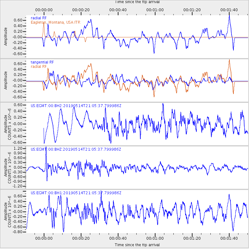
EGMT Eagleton, Montana, USA - Earthquake Result Viewer
*The percent match for this event was below the threshold and hence no stack was calculated.
| Earthquake location: |
Kuril Islands |
| Earthquake latitude/longitude: |
43.8/147.9 |
| Earthquake time(UTC): |
2019/05/14 (134) 20:55:26 GMT |
| Earthquake Depth: |
36 km |
| Earthquake Magnitude: |
5.2 Mww |
| Earthquake Catalog/Contributor: |
NEIC PDE/us |
|
| Network: |
US United States National Seismic Network |
| Station: |
EGMT Eagleton, Montana, USA |
| Lat/Lon: |
48.02 N/109.75 W |
| Elevation: |
1055 m |
|
| Distance: |
65.9 deg |
| Az: |
45.929 deg |
| Baz: |
309.25 deg |
| Ray Param: |
$rayparam |
*The percent match for this event was below the threshold and hence was not used in the summary stack. |
|
| Radial Match: |
55.641205 % |
| Radial Bump: |
400 |
| Transverse Match: |
47.86598 % |
| Transverse Bump: |
400 |
| SOD ConfigId: |
18369291 |
| Insert Time: |
2019-05-28 21:05:25.208 +0000 |
| GWidth: |
2.5 |
| Max Bumps: |
400 |
| Tol: |
0.001 |
|
Signal To Noise
| Channel | StoN | STA | LTA |
| US:EGMT:00:BHZ:20190514T21:05:37.799986Z | 2.0879812 | 3.918991E-7 | 1.8769282E-7 |
| US:EGMT:00:BH1:20190514T21:05:37.799986Z | 1.033788 | 3.0249672E-7 | 2.9261003E-7 |
| US:EGMT:00:BH2:20190514T21:05:37.799986Z | 0.6784646 | 1.9299239E-7 | 2.8445464E-7 |
| Arrivals |
| Ps | |
| PpPs | |
| PsPs/PpSs | |


