You are here: Home > Network List > US - United States National Seismic Network Stations List
> Station MSO Missoula, Montana, USA > Earthquake Result Viewer
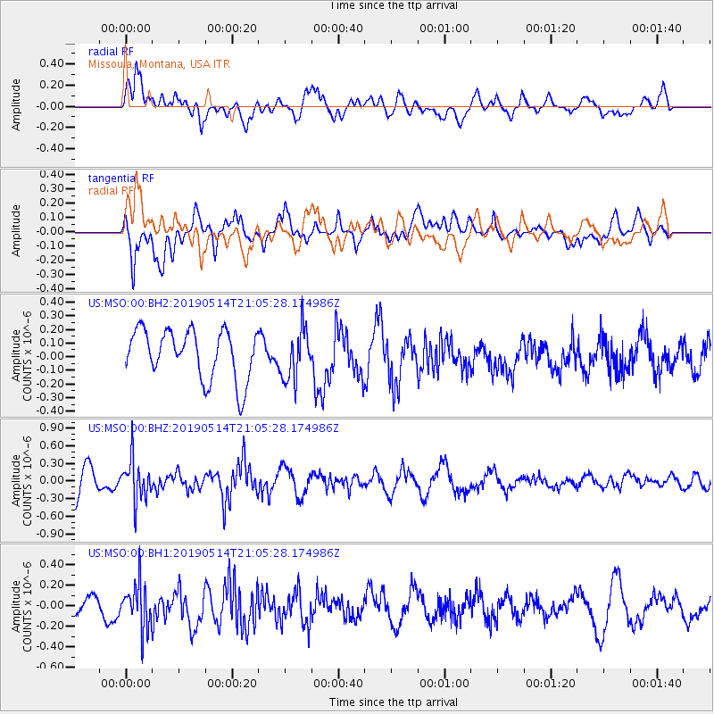
MSO Missoula, Montana, USA - Earthquake Result Viewer
*The percent match for this event was below the threshold and hence no stack was calculated.
| Earthquake location: |
Kuril Islands |
| Earthquake latitude/longitude: |
43.8/147.9 |
| Earthquake time(UTC): |
2019/05/14 (134) 20:55:26 GMT |
| Earthquake Depth: |
36 km |
| Earthquake Magnitude: |
5.2 Mww |
| Earthquake Catalog/Contributor: |
NEIC PDE/us |
|
| Network: |
US United States National Seismic Network |
| Station: |
MSO Missoula, Montana, USA |
| Lat/Lon: |
46.83 N/113.94 W |
| Elevation: |
1264 m |
|
| Distance: |
64.4 deg |
| Az: |
48.905 deg |
| Baz: |
307.426 deg |
| Ray Param: |
$rayparam |
*The percent match for this event was below the threshold and hence was not used in the summary stack. |
|
| Radial Match: |
63.10782 % |
| Radial Bump: |
400 |
| Transverse Match: |
68.54716 % |
| Transverse Bump: |
400 |
| SOD ConfigId: |
18369291 |
| Insert Time: |
2019-05-28 21:05:30.656 +0000 |
| GWidth: |
2.5 |
| Max Bumps: |
400 |
| Tol: |
0.001 |
|
Signal To Noise
| Channel | StoN | STA | LTA |
| US:MSO:00:BHZ:20190514T21:05:28.174986Z | 1.9631771 | 3.5167415E-7 | 1.7913521E-7 |
| US:MSO:00:BH1:20190514T21:05:28.174986Z | 2.3784254 | 2.1656987E-7 | 9.105599E-8 |
| US:MSO:00:BH2:20190514T21:05:28.174986Z | 1.0417401 | 1.8731735E-7 | 1.7981198E-7 |
| Arrivals |
| Ps | |
| PpPs | |
| PsPs/PpSs | |


