M19A Rock Springs, WY, USA - Earthquake Result Viewer
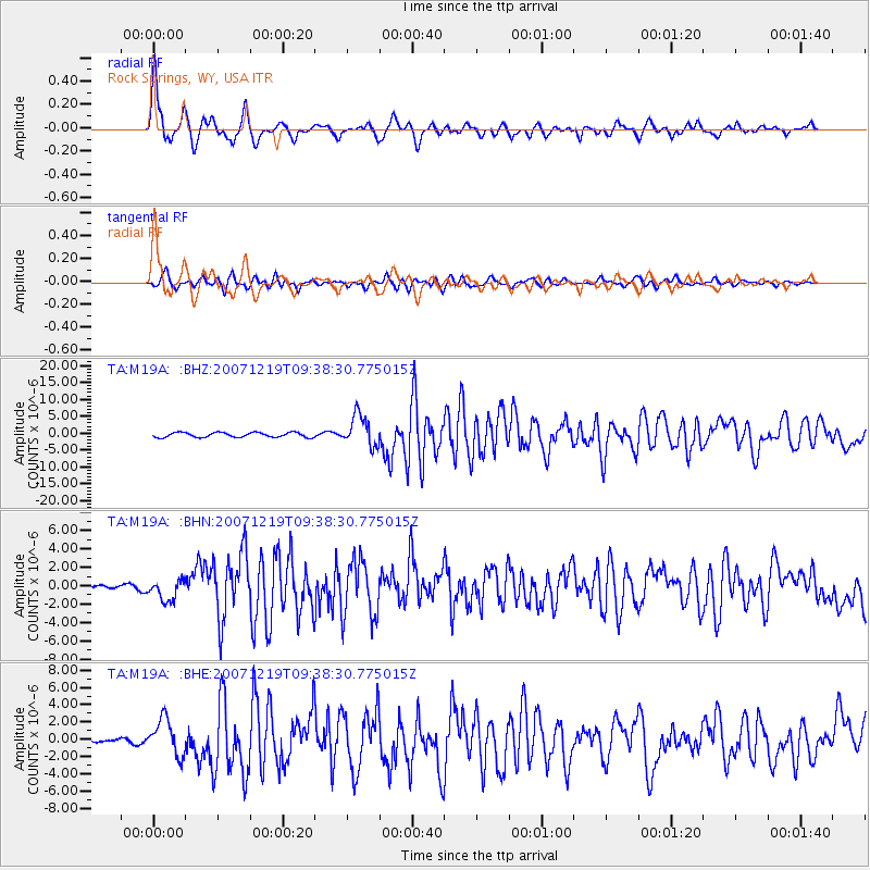
Earthquake location: Andreanof Islands, Aleutian Is.
Earthquake latitude/longitude: 51.4/-179.5
Earthquake time(UTC): 2007/12/19 (353) 09:30:27 GMT
Earthquake Depth: 29 km
Earthquake Magnitude: 6.4 MB, 7.1 MS, 7.1 MW, 7.0 MW
Earthquake Catalog/Contributor: WHDF/NEIC
Network: TA USArray Transportable Network (new EarthScope stations)
Station: M19A Rock Springs, WY, USA
Lat/Lon: 41.50 N/109.16 W
Elevation: 2080 m
Distance: 47.7 deg
Az: 72.927 deg
Baz: 307.069 deg
Ray Param: 0.06974907
Estimated Moho Depth: 13.0 km
Estimated Crust Vp/Vs: 1.60
Assumed Crust Vp: 6.207 km/s
Estimated Crust Vs: 3.879 km/s
Estimated Crust Poisson's Ratio: 0.18
Radial Match: 90.88724 %
Radial Bump: 400
Transverse Match: 85.30601 %
Transverse Bump: 400
SOD ConfigId: 2564
Insert Time: 2010-03-06 22:33:46.540 +0000
GWidth: 2.5
Max Bumps: 400
Tol: 0.001

Signal To Noise

ChannelStoNSTALTA
TA:M19A: :BHN:20071219T09:38:30.775015Z2.50987121.1518475E-64.5892693E-7
TA:M19A: :BHE:20071219T09:38:30.775015Z7.8500592.105793E-62.6825188E-7
TA:M19A: :BHZ:20071219T09:38:30.775015Z6.5671164.534966E-66.9055676E-7
Arrivals
Ps1.3 SECOND
PpPs5.1 SECOND
PsPs/PpSs6.5 SECOND