You are here: Home > Network List > TA - USArray Transportable Network (new EarthScope stations) Stations List
> Station G31M Satah River, YT, CAN > Earthquake Result Viewer
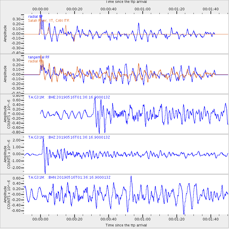
G31M Satah River, YT, CAN - Earthquake Result Viewer
*The percent match for this event was below the threshold and hence no stack was calculated.
| Earthquake location: |
New Britain Region, P.N.G. |
| Earthquake latitude/longitude: |
-5.2/152.6 |
| Earthquake time(UTC): |
2019/05/16 (136) 01:23:59 GMT |
| Earthquake Depth: |
25 km |
| Earthquake Magnitude: |
5.7 Mww |
| Earthquake Catalog/Contributor: |
NEIC PDE/us |
|
| Network: |
TA USArray Transportable Network (new EarthScope stations) |
| Station: |
G31M Satah River, YT, CAN |
| Lat/Lon: |
66.92 N/134.27 W |
| Elevation: |
61 m |
|
| Distance: |
88.2 deg |
| Az: |
22.172 deg |
| Baz: |
252.439 deg |
| Ray Param: |
$rayparam |
*The percent match for this event was below the threshold and hence was not used in the summary stack. |
|
| Radial Match: |
74.93757 % |
| Radial Bump: |
400 |
| Transverse Match: |
68.86371 % |
| Transverse Bump: |
400 |
| SOD ConfigId: |
18369291 |
| Insert Time: |
2019-05-30 01:28:23.954 +0000 |
| GWidth: |
2.5 |
| Max Bumps: |
400 |
| Tol: |
0.001 |
|
Signal To Noise
| Channel | StoN | STA | LTA |
| TA:G31M: :BHZ:20190516T01:36:16.900013Z | 11.866207 | 1.1852205E-6 | 9.988201E-8 |
| TA:G31M: :BHN:20190516T01:36:16.900013Z | 0.85008156 | 1.6112834E-7 | 1.8954456E-7 |
| TA:G31M: :BHE:20190516T01:36:16.900013Z | 3.6249087 | 3.8366176E-7 | 1.058404E-7 |
| Arrivals |
| Ps | |
| PpPs | |
| PsPs/PpSs | |


