You are here: Home > Network List > TA - USArray Transportable Network (new EarthScope stations) Stations List
> Station M19A Rock Springs, WY, USA > Earthquake Result Viewer
M19A Rock Springs, WY, USA - Earthquake Result Viewer
*The percent match for this event was below the threshold and hence no stack was calculated.
| Earthquake location: |
Hokkaido, Japan Region |
| Earthquake latitude/longitude: |
41.5/142.0 |
| Earthquake time(UTC): |
2008/04/29 (120) 05:26:04 GMT |
| Earthquake Depth: |
47 km |
| Earthquake Magnitude: |
5.5 MB, 5.2 MS, 5.8 MW, 5.8 MW |
| Earthquake Catalog/Contributor: |
WHDF/NEIC |
|
| Network: |
TA USArray Transportable Network (new EarthScope stations) |
| Station: |
M19A Rock Springs, WY, USA |
| Lat/Lon: |
41.50 N/109.16 W |
| Elevation: |
2080 m |
|
| Distance: |
75.3 deg |
| Az: |
47.303 deg |
| Baz: |
312.647 deg |
| Ray Param: |
$rayparam |
*The percent match for this event was below the threshold and hence was not used in the summary stack. |
|
| Radial Match: |
58.05683 % |
| Radial Bump: |
362 |
| Transverse Match: |
69.42199 % |
| Transverse Bump: |
400 |
| SOD ConfigId: |
2504 |
| Insert Time: |
2010-03-06 22:34:44.292 +0000 |
| GWidth: |
2.5 |
| Max Bumps: |
400 |
| Tol: |
0.001 |
|
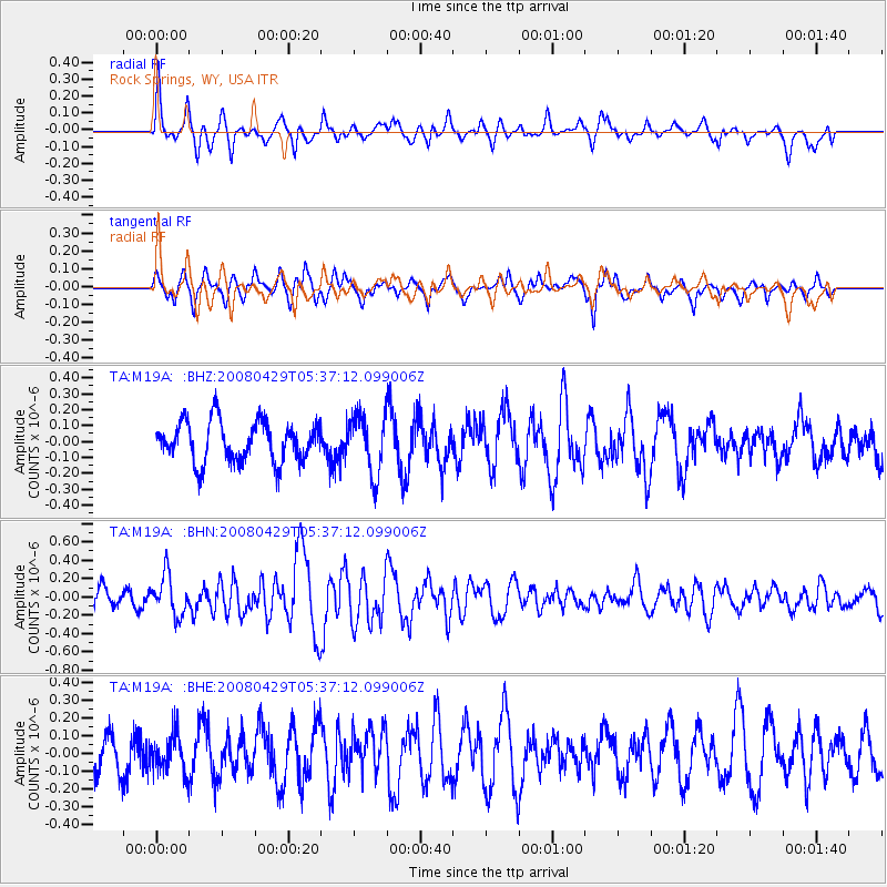
Signal To Noise
| Channel | StoN | STA | LTA |
| TA:M19A: :BHN:20080429T05:37:12.099006Z | 1.9347302 | 2.1844365E-7 | 1.1290651E-7 |
| TA:M19A: :BHE:20080429T05:37:12.099006Z | 0.9621781 | 1.04820856E-7 | 1.08941215E-7 |
| TA:M19A: :BHZ:20080429T05:37:12.099006Z | 1.4858139 | 1.8649415E-7 | 1.255165E-7 |
| Arrivals |
| Ps | |
| PpPs | |
| PsPs/PpSs | |


