You are here: Home > Network List > TS - TERRAscope (Southern California Seismic Network) Stations List
> Station GLA Glamis, California, USA > Earthquake Result Viewer
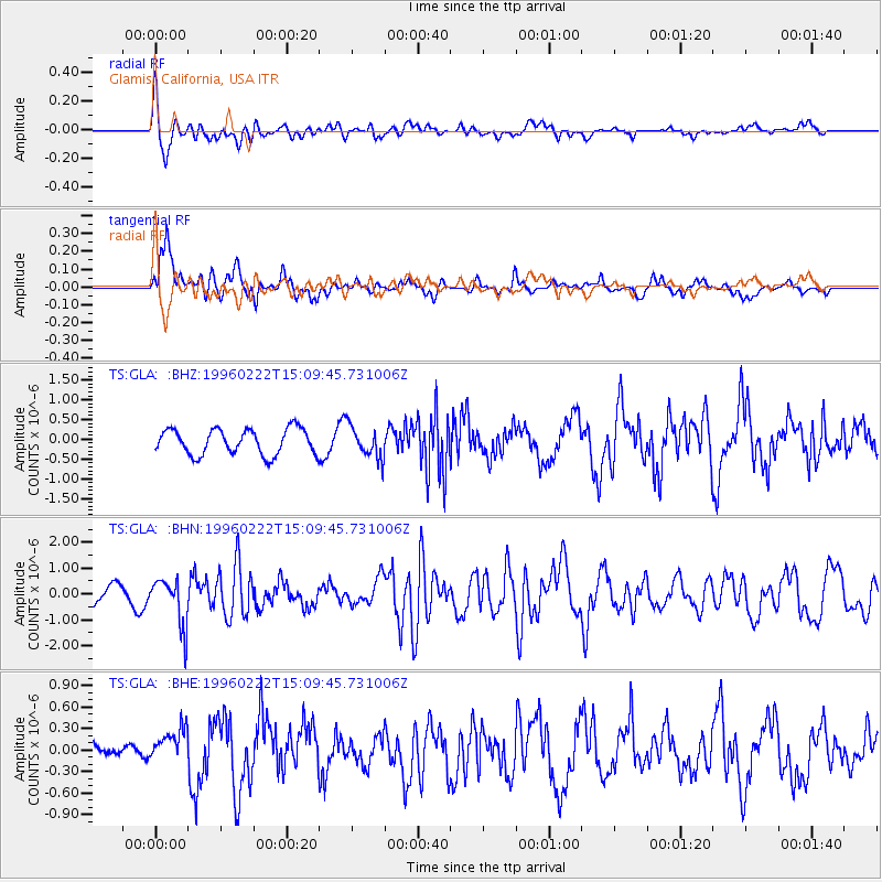
GLA Glamis, California, USA - Earthquake Result Viewer
*The percent match for this event was below the threshold and hence no stack was calculated.
| Earthquake location: |
Kuril Islands |
| Earthquake latitude/longitude: |
45.2/148.6 |
| Earthquake time(UTC): |
1996/02/22 (053) 14:59:09 GMT |
| Earthquake Depth: |
133 km |
| Earthquake Magnitude: |
6.2 MB, 6.3 UNKNOWN, 6.3 MW |
| Earthquake Catalog/Contributor: |
WHDF/NEIC |
|
| Network: |
TS TERRAscope (Southern California Seismic Network) |
| Station: |
GLA Glamis, California, USA |
| Lat/Lon: |
33.05 N/114.83 W |
| Elevation: |
627 m |
|
| Distance: |
71.6 deg |
| Az: |
61.542 deg |
| Baz: |
312.268 deg |
| Ray Param: |
$rayparam |
*The percent match for this event was below the threshold and hence was not used in the summary stack. |
|
| Radial Match: |
71.34241 % |
| Radial Bump: |
400 |
| Transverse Match: |
62.79023 % |
| Transverse Bump: |
400 |
| SOD ConfigId: |
4480 |
| Insert Time: |
2010-02-26 14:13:18.522 +0000 |
| GWidth: |
2.5 |
| Max Bumps: |
400 |
| Tol: |
0.001 |
|
Signal To Noise
| Channel | StoN | STA | LTA |
| TS:GLA: :BHN:19960222T15:09:45.731006Z | 2.6281328 | 9.148277E-7 | 3.4809034E-7 |
| TS:GLA: :BHE:19960222T15:09:45.731006Z | 0.9953489 | 2.519517E-7 | 2.53129E-7 |
| TS:GLA: :BHZ:19960222T15:09:45.731006Z | 1.2505342 | 4.0417058E-7 | 3.2319835E-7 |
| Arrivals |
| Ps | |
| PpPs | |
| PsPs/PpSs | |


