You are here: Home > Network List > TS - TERRAscope (Southern California Seismic Network) Stations List
> Station GLA Glamis, California, USA > Earthquake Result Viewer
GLA Glamis, California, USA - Earthquake Result Viewer
*The percent match for this event was below the threshold and hence no stack was calculated.
| Earthquake location: |
Near Coast Of Nicaragua |
| Earthquake latitude/longitude: |
11.7/-86.9 |
| Earthquake time(UTC): |
1996/03/03 (063) 14:58:58 GMT |
| Earthquake Depth: |
33 km |
| Earthquake Magnitude: |
5.5 MB |
| Earthquake Catalog/Contributor: |
WHDF/NEIC |
|
| Network: |
TS TERRAscope (Southern California Seismic Network) |
| Station: |
GLA Glamis, California, USA |
| Lat/Lon: |
33.05 N/114.83 W |
| Elevation: |
627 m |
|
| Distance: |
33.2 deg |
| Az: |
314.129 deg |
| Baz: |
123.175 deg |
| Ray Param: |
$rayparam |
*The percent match for this event was below the threshold and hence was not used in the summary stack. |
|
| Radial Match: |
54.80385 % |
| Radial Bump: |
400 |
| Transverse Match: |
58.837223 % |
| Transverse Bump: |
400 |
| SOD ConfigId: |
4480 |
| Insert Time: |
2010-02-26 14:13:20.060 +0000 |
| GWidth: |
2.5 |
| Max Bumps: |
400 |
| Tol: |
0.001 |
|
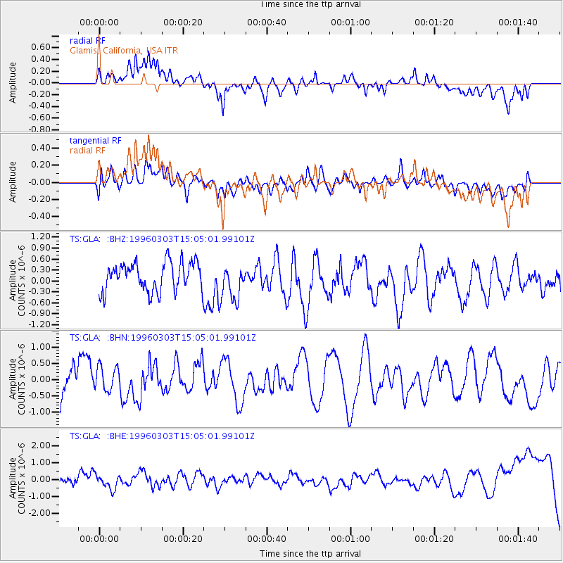
Signal To Noise
| Channel | StoN | STA | LTA |
| TS:GLA: :BHN:19960303T15:05:01.99101Z | 0.7842882 | 3.9581698E-7 | 5.0468304E-7 |
| TS:GLA: :BHE:19960303T15:05:01.99101Z | 1.179293 | 3.800014E-7 | 3.2222815E-7 |
| TS:GLA: :BHZ:19960303T15:05:01.99101Z | 1.2384928 | 4.879604E-7 | 3.9399532E-7 |
| Arrivals |
| Ps | |
| PpPs | |
| PsPs/PpSs | |


