You are here: Home > Network List > TA - USArray Transportable Network (new EarthScope stations) Stations List
> Station B18K Kokolik River, AK, USA > Earthquake Result Viewer
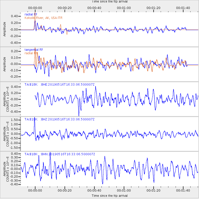
B18K Kokolik River, AK, USA - Earthquake Result Viewer
*The percent match for this event was below the threshold and hence no stack was calculated.
| Earthquake location: |
Near Coast Of Nicaragua |
| Earthquake latitude/longitude: |
12.6/-87.9 |
| Earthquake time(UTC): |
2019/05/16 (136) 16:22:16 GMT |
| Earthquake Depth: |
62 km |
| Earthquake Magnitude: |
5.9 Mww |
| Earthquake Catalog/Contributor: |
NEIC PDE/us |
|
| Network: |
TA USArray Transportable Network (new EarthScope stations) |
| Station: |
B18K Kokolik River, AK, USA |
| Lat/Lon: |
69.36 N/161.80 W |
| Elevation: |
222 m |
|
| Distance: |
72.6 deg |
| Az: |
339.085 deg |
| Baz: |
100.593 deg |
| Ray Param: |
$rayparam |
*The percent match for this event was below the threshold and hence was not used in the summary stack. |
|
| Radial Match: |
51.30047 % |
| Radial Bump: |
400 |
| Transverse Match: |
67.889534 % |
| Transverse Bump: |
400 |
| SOD ConfigId: |
18369291 |
| Insert Time: |
2019-05-30 16:28:21.108 +0000 |
| GWidth: |
2.5 |
| Max Bumps: |
400 |
| Tol: |
0.001 |
|
Signal To Noise
| Channel | StoN | STA | LTA |
| TA:B18K: :BHZ:20190516T16:33:06.500007Z | 5.280778 | 5.712377E-7 | 1.08173026E-7 |
| TA:B18K: :BHN:20190516T16:33:06.500007Z | 1.7009326 | 1.5995731E-7 | 9.404095E-8 |
| TA:B18K: :BHE:20190516T16:33:06.500007Z | 2.166575 | 2.2088359E-7 | 1.0195058E-7 |
| Arrivals |
| Ps | |
| PpPs | |
| PsPs/PpSs | |


