L20A Wamsutter, WY, USA - Earthquake Result Viewer
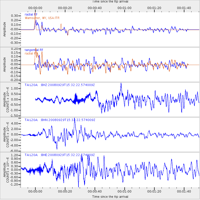
Earthquake location: Kermadec Islands, New Zealand
Earthquake latitude/longitude: -29.8/-177.7
Earthquake time(UTC): 2008/09/29 (273) 15:19:31 GMT
Earthquake Depth: 36 km
Earthquake Magnitude: 6.5 MB, 6.7 MS, 7.0 MW, 7.0 MW
Earthquake Catalog/Contributor: WHDF/NEIC
Network: TA USArray Transportable Network (new EarthScope stations)
Station: L20A Wamsutter, WY, USA
Lat/Lon: 42.01 N/108.34 W
Elevation: 2028 m
Distance: 95.8 deg
Az: 44.502 deg
Baz: 234.867 deg
Ray Param: 0.040676467
Estimated Moho Depth: 10.0 km
Estimated Crust Vp/Vs: 1.92
Assumed Crust Vp: 6.161 km/s
Estimated Crust Vs: 3.209 km/s
Estimated Crust Poisson's Ratio: 0.31
Radial Match: 90.883446 %
Radial Bump: 400
Transverse Match: 75.011795 %
Transverse Bump: 400
SOD ConfigId: 2560
Insert Time: 2010-03-06 22:36:43.378 +0000
GWidth: 2.5
Max Bumps: 400
Tol: 0.001

Signal To Noise

ChannelStoNSTALTA
TA:L20A: :BHN:20080929T15:32:22.574009Z3.40178184.6381325E-71.3634421E-7
TA:L20A: :BHE:20080929T15:32:22.574009Z0.79814851.48386E-71.8591277E-7
TA:L20A: :BHZ:20080929T15:32:22.574009Z1.27778611.7043948E-71.3338654E-7
Arrivals
Ps1.5 SECOND
PpPs4.7 SECOND
PsPs/PpSs6.2 SECOND