You are here: Home > Network List > TA - USArray Transportable Network (new EarthScope stations) Stations List
> Station L20A Wamsutter, WY, USA > Earthquake Result Viewer
L20A Wamsutter, WY, USA - Earthquake Result Viewer

| Earthquake location: |
Southeast Of Honshu, Japan |
| Earthquake latitude/longitude: |
32.8/140.4 |
| Earthquake time(UTC): |
2009/08/12 (224) 22:48:51 GMT |
| Earthquake Depth: |
53 km |
| Earthquake Magnitude: |
6.2 MB, 6.6 MW, 6.6 MW |
| Earthquake Catalog/Contributor: |
WHDF/NEIC |
|
| Network: |
TA USArray Transportable Network (new EarthScope stations) |
| Station: |
L20A Wamsutter, WY, USA |
| Lat/Lon: |
42.01 N/108.34 W |
| Elevation: |
2028 m |
|
| Distance: |
82.4 deg |
| Az: |
44.482 deg |
| Baz: |
307.663 deg |
| Ray Param: |
0.046811942 |
| Estimated Moho Depth: |
10.0 km |
| Estimated Crust Vp/Vs: |
1.80 |
| Assumed Crust Vp: |
6.161 km/s |
| Estimated Crust Vs: |
3.418 km/s |
| Estimated Crust Poisson's Ratio: |
0.28 |
|
| Radial Match: |
90.3036 % |
| Radial Bump: |
400 |
| Transverse Match: |
81.23477 % |
| Transverse Bump: |
400 |
| SOD ConfigId: |
2622 |
| Insert Time: |
2010-03-06 22:36:51.628 +0000 |
| GWidth: |
2.5 |
| Max Bumps: |
400 |
| Tol: |
0.001 |
|
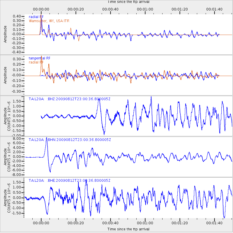
Signal To Noise
| Channel | StoN | STA | LTA |
| TA:L20A: :BHN:20090812T23:00:36.800005Z | 37.940094 | 3.6759989E-6 | 9.688955E-8 |
| TA:L20A: :BHE:20090812T23:00:36.800005Z | 8.977724 | 7.001185E-7 | 7.798397E-8 |
| TA:L20A: :BHZ:20090812T23:00:36.800005Z | 8.85838 | 8.391435E-7 | 9.472878E-8 |
| Arrivals |
| Ps | 1.3 SECOND |
| PpPs | 4.4 SECOND |
| PsPs/PpSs | 5.8 SECOND |


