L20A Wamsutter, WY, USA - Earthquake Result Viewer
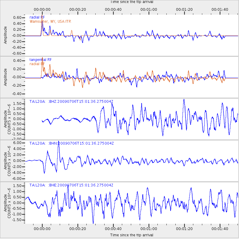
Earthquake location: Rat Islands, Aleutian Islands
Earthquake latitude/longitude: 50.4/177.0
Earthquake time(UTC): 2009/07/06 (187) 14:53:12 GMT
Earthquake Depth: 22 km
Earthquake Magnitude: 6.0 MB, 5.8 MS, 6.1 MW, 6.0 MW
Earthquake Catalog/Contributor: WHDF/NEIC
Network: TA USArray Transportable Network (new EarthScope stations)
Station: L20A Wamsutter, WY, USA
Lat/Lon: 42.01 N/108.34 W
Elevation: 2028 m
Distance: 50.3 deg
Az: 69.072 deg
Baz: 306.732 deg
Ray Param: 0.06811006
Estimated Moho Depth: 63.0 km
Estimated Crust Vp/Vs: 2.10
Assumed Crust Vp: 6.161 km/s
Estimated Crust Vs: 2.941 km/s
Estimated Crust Poisson's Ratio: 0.35
Radial Match: 80.02132 %
Radial Bump: 400
Transverse Match: 74.45031 %
Transverse Bump: 400
SOD ConfigId: 2648
Insert Time: 2010-03-06 22:37:24.326 +0000
GWidth: 2.5
Max Bumps: 400
Tol: 0.001

Signal To Noise

ChannelStoNSTALTA
TA:L20A: :BHN:20090706T15:01:36.275004Z8.2130381.879473E-62.2884016E-7
TA:L20A: :BHE:20090706T15:01:36.275004Z1.80469386.3222143E-73.5032062E-7
TA:L20A: :BHZ:20090706T15:01:36.275004Z4.8113187.8499954E-71.6315686E-7
Arrivals
Ps12 SECOND
PpPs30 SECOND
PsPs/PpSs42 SECOND