You are here: Home > Network List > TS - TERRAscope (Southern California Seismic Network) Stations List
> Station GLA Glamis, California, USA > Earthquake Result Viewer
GLA Glamis, California, USA - Earthquake Result Viewer
*The percent match for this event was below the threshold and hence no stack was calculated.
| Earthquake location: |
Kuril Islands |
| Earthquake latitude/longitude: |
43.5/147.5 |
| Earthquake time(UTC): |
1994/10/05 (278) 20:37:31 GMT |
| Earthquake Depth: |
33 km |
| Earthquake Magnitude: |
5.7 MB, 5.9 MS, 5.9 UNKNOWN, 5.9 MW |
| Earthquake Catalog/Contributor: |
WHDF/NEIC |
|
| Network: |
TS TERRAscope (Southern California Seismic Network) |
| Station: |
GLA Glamis, California, USA |
| Lat/Lon: |
33.05 N/114.83 W |
| Elevation: |
627 m |
|
| Distance: |
73.1 deg |
| Az: |
60.437 deg |
| Baz: |
311.14 deg |
| Ray Param: |
$rayparam |
*The percent match for this event was below the threshold and hence was not used in the summary stack. |
|
| Radial Match: |
45.820232 % |
| Radial Bump: |
400 |
| Transverse Match: |
46.774837 % |
| Transverse Bump: |
400 |
| SOD ConfigId: |
4480 |
| Insert Time: |
2010-02-26 14:13:24.013 +0000 |
| GWidth: |
2.5 |
| Max Bumps: |
400 |
| Tol: |
0.001 |
|
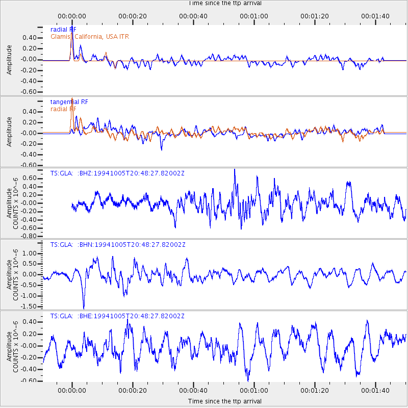
Signal To Noise
| Channel | StoN | STA | LTA |
| TS:GLA: :BHN:19941005T20:48:27.82002Z | 4.1865745 | 5.1799634E-7 | 1.2372797E-7 |
| TS:GLA: :BHE:19941005T20:48:27.82002Z | 0.9712402 | 3.2644394E-7 | 3.361104E-7 |
| TS:GLA: :BHZ:19941005T20:48:27.82002Z | 2.1168942 | 2.273872E-7 | 1.0741548E-7 |
| Arrivals |
| Ps | |
| PpPs | |
| PsPs/PpSs | |


