You are here: Home > Network List > US - United States National Seismic Network Stations List
> Station MSO Missoula, Montana, USA > Earthquake Result Viewer
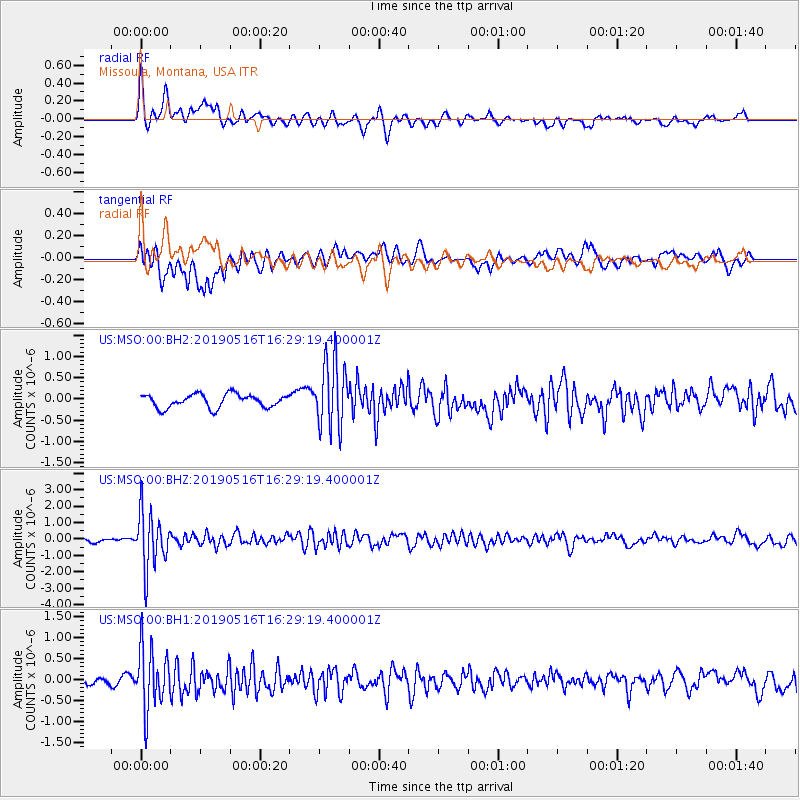
MSO Missoula, Montana, USA - Earthquake Result Viewer
*The percent match for this event was below the threshold and hence no stack was calculated.
| Earthquake location: |
Near Coast Of Nicaragua |
| Earthquake latitude/longitude: |
12.6/-87.9 |
| Earthquake time(UTC): |
2019/05/16 (136) 16:22:16 GMT |
| Earthquake Depth: |
62 km |
| Earthquake Magnitude: |
5.9 Mww |
| Earthquake Catalog/Contributor: |
NEIC PDE/us |
|
| Network: |
US United States National Seismic Network |
| Station: |
MSO Missoula, Montana, USA |
| Lat/Lon: |
46.83 N/113.94 W |
| Elevation: |
1264 m |
|
| Distance: |
40.5 deg |
| Az: |
332.329 deg |
| Baz: |
138.684 deg |
| Ray Param: |
$rayparam |
*The percent match for this event was below the threshold and hence was not used in the summary stack. |
|
| Radial Match: |
74.629234 % |
| Radial Bump: |
400 |
| Transverse Match: |
61.744434 % |
| Transverse Bump: |
400 |
| SOD ConfigId: |
18369291 |
| Insert Time: |
2019-05-30 16:30:14.037 +0000 |
| GWidth: |
2.5 |
| Max Bumps: |
400 |
| Tol: |
0.001 |
|
Signal To Noise
| Channel | StoN | STA | LTA |
| US:MSO:00:BHZ:20190516T16:29:19.400001Z | 10.374052 | 1.7036333E-6 | 1.6422062E-7 |
| US:MSO:00:BH1:20190516T16:29:19.400001Z | 7.4883704 | 7.3362935E-7 | 9.796915E-8 |
| US:MSO:00:BH2:20190516T16:29:19.400001Z | 5.038938 | 7.8956367E-7 | 1.5669248E-7 |
| Arrivals |
| Ps | |
| PpPs | |
| PsPs/PpSs | |


