You are here: Home > Network List > TS - TERRAscope (Southern California Seismic Network) Stations List
> Station GLA Glamis, California, USA > Earthquake Result Viewer
GLA Glamis, California, USA - Earthquake Result Viewer
*The percent match for this event was below the threshold and hence no stack was calculated.
| Earthquake location: |
East Of Kuril Islands |
| Earthquake latitude/longitude: |
43.8/148.1 |
| Earthquake time(UTC): |
1994/10/09 (282) 08:48:54 GMT |
| Earthquake Depth: |
35 km |
| Earthquake Magnitude: |
5.8 MB |
| Earthquake Catalog/Contributor: |
WHDF/NEIC |
|
| Network: |
TS TERRAscope (Southern California Seismic Network) |
| Station: |
GLA Glamis, California, USA |
| Lat/Lon: |
33.05 N/114.83 W |
| Elevation: |
627 m |
|
| Distance: |
72.6 deg |
| Az: |
60.862 deg |
| Baz: |
311.164 deg |
| Ray Param: |
$rayparam |
*The percent match for this event was below the threshold and hence was not used in the summary stack. |
|
| Radial Match: |
54.162415 % |
| Radial Bump: |
400 |
| Transverse Match: |
44.02312 % |
| Transverse Bump: |
400 |
| SOD ConfigId: |
4480 |
| Insert Time: |
2010-02-26 14:13:25.978 +0000 |
| GWidth: |
2.5 |
| Max Bumps: |
400 |
| Tol: |
0.001 |
|
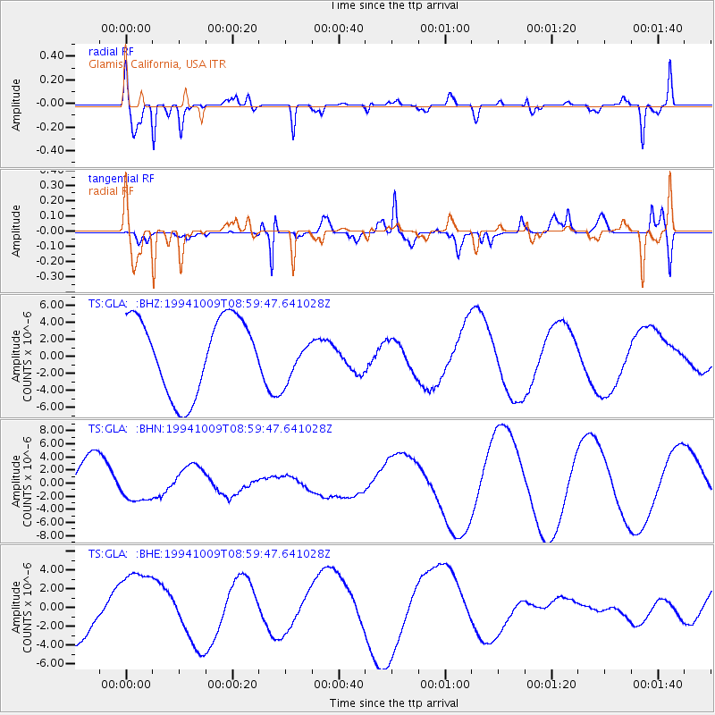
Signal To Noise
| Channel | StoN | STA | LTA |
| TS:GLA: :BHN:19941009T08:59:47.641028Z | 0.55707514 | 2.6099303E-6 | 4.6850596E-6 |
| TS:GLA: :BHE:19941009T08:59:47.641028Z | 1.7509894 | 4.148446E-6 | 2.369201E-6 |
| TS:GLA: :BHZ:19941009T08:59:47.641028Z | 0.6024267 | 2.6631474E-6 | 4.4206995E-6 |
| Arrivals |
| Ps | |
| PpPs | |
| PsPs/PpSs | |


