You are here: Home > Network List > TA - USArray Transportable Network (new EarthScope stations) Stations List
> Station L20A Wamsutter, WY, USA > Earthquake Result Viewer
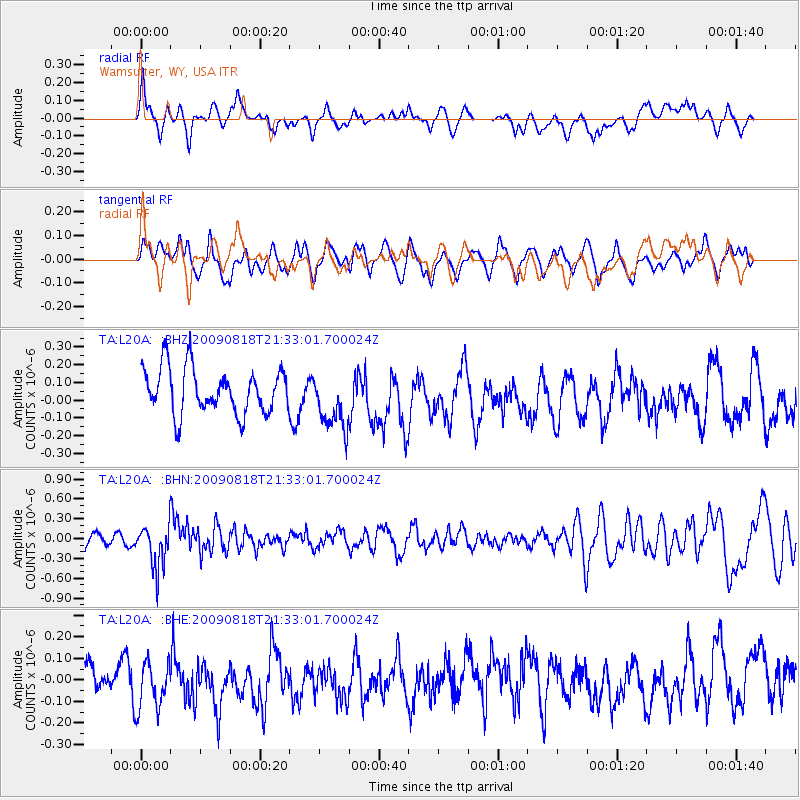
L20A Wamsutter, WY, USA - Earthquake Result Viewer
*The percent match for this event was below the threshold and hence no stack was calculated.
| Earthquake location: |
South Of Fiji Islands |
| Earthquake latitude/longitude: |
-26.1/-178.4 |
| Earthquake time(UTC): |
2009/08/18 (230) 21:20:47 GMT |
| Earthquake Depth: |
270 km |
| Earthquake Magnitude: |
5.5 MB, 6.3 MW, 6.3 MW |
| Earthquake Catalog/Contributor: |
WHDF/NEIC |
|
| Network: |
TA USArray Transportable Network (new EarthScope stations) |
| Station: |
L20A Wamsutter, WY, USA |
| Lat/Lon: |
42.01 N/108.34 W |
| Elevation: |
2028 m |
|
| Distance: |
93.6 deg |
| Az: |
44.584 deg |
| Baz: |
237.904 deg |
| Ray Param: |
$rayparam |
*The percent match for this event was below the threshold and hence was not used in the summary stack. |
|
| Radial Match: |
56.811787 % |
| Radial Bump: |
400 |
| Transverse Match: |
48.264942 % |
| Transverse Bump: |
400 |
| SOD ConfigId: |
2622 |
| Insert Time: |
2010-03-06 22:38:17.376 +0000 |
| GWidth: |
2.5 |
| Max Bumps: |
400 |
| Tol: |
0.001 |
|
Signal To Noise
| Channel | StoN | STA | LTA |
| TA:L20A: :BHN:20090818T21:33:01.700024Z | 3.1651394 | 3.1851684E-7 | 1.00632796E-7 |
| TA:L20A: :BHE:20090818T21:33:01.700024Z | 1.36631 | 1.2041426E-7 | 8.813099E-8 |
| TA:L20A: :BHZ:20090818T21:33:01.700024Z | 1.2747283 | 1.6165065E-7 | 1.2681184E-7 |
| Arrivals |
| Ps | |
| PpPs | |
| PsPs/PpSs | |


