You are here: Home > Network List > TA - USArray Transportable Network (new EarthScope stations) Stations List
> Station L20A Wamsutter, WY, USA > Earthquake Result Viewer
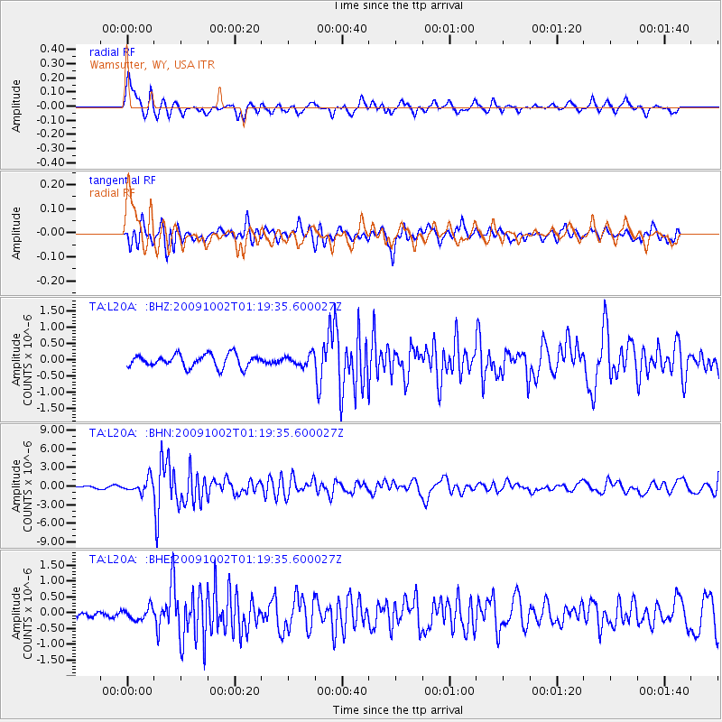
L20A Wamsutter, WY, USA - Earthquake Result Viewer
*The percent match for this event was below the threshold and hence no stack was calculated.
| Earthquake location: |
Tonga Islands |
| Earthquake latitude/longitude: |
-16.3/-173.5 |
| Earthquake time(UTC): |
2009/10/02 (275) 01:07:39 GMT |
| Earthquake Depth: |
8.0 km |
| Earthquake Magnitude: |
6.1 MB, 6.0 MS, 6.1 MW, 6.1 MW |
| Earthquake Catalog/Contributor: |
WHDF/NEIC |
|
| Network: |
TA USArray Transportable Network (new EarthScope stations) |
| Station: |
L20A Wamsutter, WY, USA |
| Lat/Lon: |
42.01 N/108.34 W |
| Elevation: |
2028 m |
|
| Distance: |
83.4 deg |
| Az: |
42.895 deg |
| Baz: |
241.269 deg |
| Ray Param: |
$rayparam |
*The percent match for this event was below the threshold and hence was not used in the summary stack. |
|
| Radial Match: |
78.48819 % |
| Radial Bump: |
393 |
| Transverse Match: |
75.62579 % |
| Transverse Bump: |
400 |
| SOD ConfigId: |
2622 |
| Insert Time: |
2010-03-06 22:38:23.036 +0000 |
| GWidth: |
2.5 |
| Max Bumps: |
400 |
| Tol: |
0.001 |
|
Signal To Noise
| Channel | StoN | STA | LTA |
| TA:L20A: :BHN:20091002T01:19:35.600027Z | 7.3824515 | 1.1084054E-6 | 1.5014056E-7 |
| TA:L20A: :BHE:20091002T01:19:35.600027Z | 1.2606415 | 1.9040777E-7 | 1.510404E-7 |
| TA:L20A: :BHZ:20091002T01:19:35.600027Z | 0.85901344 | 1.7037678E-7 | 1.9834006E-7 |
| Arrivals |
| Ps | |
| PpPs | |
| PsPs/PpSs | |


