You are here: Home > Network List > GS - US Geological Survey Networks Stations List
> Station KAN08 Pence Farm, Harper, KS, USA > Earthquake Result Viewer
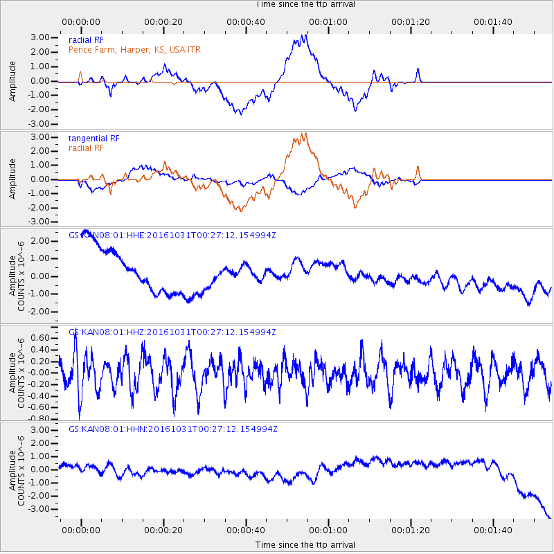
KAN08 Pence Farm, Harper, KS, USA - Earthquake Result Viewer
*The percent match for this event was below the threshold and hence no stack was calculated.
| Earthquake location: |
Colombia |
| Earthquake latitude/longitude: |
3.4/-74.5 |
| Earthquake time(UTC): |
2016/10/31 (305) 00:20:11 GMT |
| Earthquake Depth: |
33 km |
| Earthquake Magnitude: |
5.6 MWW, 5.4 MWB |
| Earthquake Catalog/Contributor: |
NEIC PDE/NEIC COMCAT |
|
| Network: |
GS US Geological Survey Networks |
| Station: |
KAN08 Pence Farm, Harper, KS, USA |
| Lat/Lon: |
37.23 N/97.97 W |
| Elevation: |
375 m |
|
| Distance: |
40.0 deg |
| Az: |
330.314 deg |
| Baz: |
141.731 deg |
| Ray Param: |
$rayparam |
*The percent match for this event was below the threshold and hence was not used in the summary stack. |
|
| Radial Match: |
18.395664 % |
| Radial Bump: |
400 |
| Transverse Match: |
22.476852 % |
| Transverse Bump: |
400 |
| SOD ConfigId: |
1815711 |
| Insert Time: |
2016-11-14 00:20:59.432 +0000 |
| GWidth: |
2.5 |
| Max Bumps: |
400 |
| Tol: |
0.001 |
|
Signal To Noise
| Channel | StoN | STA | LTA |
| GS:KAN08:01:HHZ:20161031T00:27:12.154994Z | 2.3045862 | 3.348338E-7 | 1.452902E-7 |
| GS:KAN08:01:HHN:20161031T00:27:12.154994Z | 1.7140177 | 4.108865E-7 | 2.397213E-7 |
| GS:KAN08:01:HHE:20161031T00:27:12.154994Z | 0.73779553 | 9.1400494E-7 | 1.2388323E-6 |
| Arrivals |
| Ps | |
| PpPs | |
| PsPs/PpSs | |


