You are here: Home > Network List > TA - USArray Transportable Network (new EarthScope stations) Stations List
> Station L20A Wamsutter, WY, USA > Earthquake Result Viewer
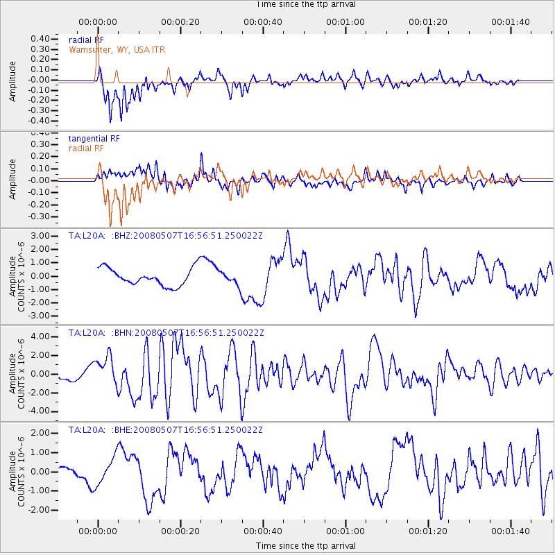
L20A Wamsutter, WY, USA - Earthquake Result Viewer
*The percent match for this event was below the threshold and hence no stack was calculated.
| Earthquake location: |
Near East Coast Of Honshu, Japan |
| Earthquake latitude/longitude: |
36.2/141.5 |
| Earthquake time(UTC): |
2008/05/07 (128) 16:45:20 GMT |
| Earthquake Depth: |
39 km |
| Earthquake Magnitude: |
6.1 MB, 6.7 MS, 6.8 MW, 6.8 MW |
| Earthquake Catalog/Contributor: |
WHDF/NEIC |
|
| Network: |
TA USArray Transportable Network (new EarthScope stations) |
| Station: |
L20A Wamsutter, WY, USA |
| Lat/Lon: |
42.01 N/108.34 W |
| Elevation: |
2028 m |
|
| Distance: |
79.4 deg |
| Az: |
45.388 deg |
| Baz: |
309.377 deg |
| Ray Param: |
$rayparam |
*The percent match for this event was below the threshold and hence was not used in the summary stack. |
|
| Radial Match: |
80.917496 % |
| Radial Bump: |
400 |
| Transverse Match: |
69.97411 % |
| Transverse Bump: |
400 |
| SOD ConfigId: |
2504 |
| Insert Time: |
2010-03-06 22:38:59.837 +0000 |
| GWidth: |
2.5 |
| Max Bumps: |
400 |
| Tol: |
0.001 |
|
Signal To Noise
| Channel | StoN | STA | LTA |
| TA:L20A: :BHN:20080507T16:56:51.250022Z | 3.3488703 | 1.6040008E-6 | 4.789677E-7 |
| TA:L20A: :BHE:20080507T16:56:51.250022Z | 4.1243443 | 7.1638897E-7 | 1.7369764E-7 |
| TA:L20A: :BHZ:20080507T16:56:51.250022Z | 0.8149829 | 5.3431177E-7 | 6.5561096E-7 |
| Arrivals |
| Ps | |
| PpPs | |
| PsPs/PpSs | |


