You are here: Home > Network List > TA - USArray Transportable Network (new EarthScope stations) Stations List
> Station L20A Wamsutter, WY, USA > Earthquake Result Viewer
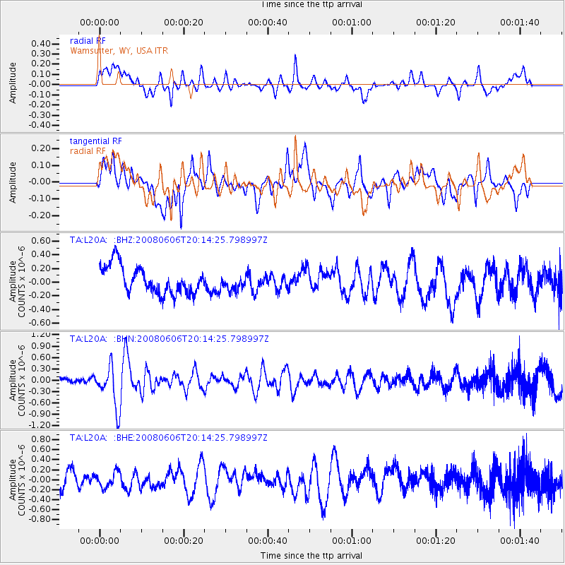
L20A Wamsutter, WY, USA - Earthquake Result Viewer
*The percent match for this event was below the threshold and hence no stack was calculated.
| Earthquake location: |
Northern Algeria |
| Earthquake latitude/longitude: |
35.9/-0.7 |
| Earthquake time(UTC): |
2008/06/06 (158) 20:02:56 GMT |
| Earthquake Depth: |
4.0 km |
| Earthquake Magnitude: |
5.5 MB, 5.3 MS, 5.5 MW, 5.5 MW |
| Earthquake Catalog/Contributor: |
WHDF/NEIC |
|
| Network: |
TA USArray Transportable Network (new EarthScope stations) |
| Station: |
L20A Wamsutter, WY, USA |
| Lat/Lon: |
42.01 N/108.34 W |
| Elevation: |
2028 m |
|
| Distance: |
78.2 deg |
| Az: |
313.487 deg |
| Baz: |
52.237 deg |
| Ray Param: |
$rayparam |
*The percent match for this event was below the threshold and hence was not used in the summary stack. |
|
| Radial Match: |
37.609314 % |
| Radial Bump: |
400 |
| Transverse Match: |
45.53063 % |
| Transverse Bump: |
400 |
| SOD ConfigId: |
2504 |
| Insert Time: |
2010-03-06 22:39:00.649 +0000 |
| GWidth: |
2.5 |
| Max Bumps: |
400 |
| Tol: |
0.001 |
|
Signal To Noise
| Channel | StoN | STA | LTA |
| TA:L20A: :BHN:20080606T20:14:25.798997Z | 5.8976893 | 5.5963574E-7 | 9.489068E-8 |
| TA:L20A: :BHE:20080606T20:14:25.798997Z | 1.0617172 | 1.5210502E-7 | 1.4326322E-7 |
| TA:L20A: :BHZ:20080606T20:14:25.798997Z | 0.5309972 | 1.05801035E-7 | 1.9924971E-7 |
| Arrivals |
| Ps | |
| PpPs | |
| PsPs/PpSs | |


