You are here: Home > Network List > TA - USArray Transportable Network (new EarthScope stations) Stations List
> Station L20A Wamsutter, WY, USA > Earthquake Result Viewer
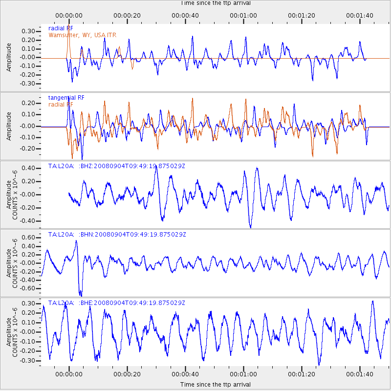
L20A Wamsutter, WY, USA - Earthquake Result Viewer
*The percent match for this event was below the threshold and hence no stack was calculated.
| Earthquake location: |
Santa Cruz Islands |
| Earthquake latitude/longitude: |
-12.1/167.1 |
| Earthquake time(UTC): |
2008/09/04 (248) 09:37:03 GMT |
| Earthquake Depth: |
272 km |
| Earthquake Magnitude: |
5.5 MB, 5.7 MW, 5.6 MW |
| Earthquake Catalog/Contributor: |
WHDF/NEIC |
|
| Network: |
TA USArray Transportable Network (new EarthScope stations) |
| Station: |
L20A Wamsutter, WY, USA |
| Lat/Lon: |
42.01 N/108.34 W |
| Elevation: |
2028 m |
|
| Distance: |
94.0 deg |
| Az: |
48.054 deg |
| Baz: |
257.401 deg |
| Ray Param: |
$rayparam |
*The percent match for this event was below the threshold and hence was not used in the summary stack. |
|
| Radial Match: |
65.005806 % |
| Radial Bump: |
400 |
| Transverse Match: |
43.1913 % |
| Transverse Bump: |
360 |
| SOD ConfigId: |
2504 |
| Insert Time: |
2010-03-06 22:39:16.177 +0000 |
| GWidth: |
2.5 |
| Max Bumps: |
400 |
| Tol: |
0.001 |
|
Signal To Noise
| Channel | StoN | STA | LTA |
| TA:L20A: :BHN:20080904T09:49:19.875029Z | 2.19958 | 3.9600468E-7 | 1.800365E-7 |
| TA:L20A: :BHE:20080904T09:49:19.875029Z | 1.2296413 | 1.6710891E-7 | 1.3590054E-7 |
| TA:L20A: :BHZ:20080904T09:49:19.875029Z | 2.7098753 | 2.596674E-7 | 9.5822635E-8 |
| Arrivals |
| Ps | |
| PpPs | |
| PsPs/PpSs | |


