You are here: Home > Network List > TS - TERRAscope (Southern California Seismic Network) Stations List
> Station GLA Glamis, California, USA > Earthquake Result Viewer
GLA Glamis, California, USA - Earthquake Result Viewer
*The percent match for this event was below the threshold and hence no stack was calculated.
| Earthquake location: |
Southern Argentina |
| Earthquake latitude/longitude: |
-39.2/-70.8 |
| Earthquake time(UTC): |
1994/10/20 (293) 01:15:16 GMT |
| Earthquake Depth: |
164 km |
| Earthquake Magnitude: |
5.7 MB, 5.9 UNKNOWN, 6.2 MW |
| Earthquake Catalog/Contributor: |
WHDF/NEIC |
|
| Network: |
TS TERRAscope (Southern California Seismic Network) |
| Station: |
GLA Glamis, California, USA |
| Lat/Lon: |
33.05 N/114.83 W |
| Elevation: |
627 m |
|
| Distance: |
82.7 deg |
| Az: |
323.947 deg |
| Baz: |
147.006 deg |
| Ray Param: |
$rayparam |
*The percent match for this event was below the threshold and hence was not used in the summary stack. |
|
| Radial Match: |
41.41515 % |
| Radial Bump: |
400 |
| Transverse Match: |
69.878204 % |
| Transverse Bump: |
378 |
| SOD ConfigId: |
4480 |
| Insert Time: |
2010-02-26 14:13:28.007 +0000 |
| GWidth: |
2.5 |
| Max Bumps: |
400 |
| Tol: |
0.001 |
|
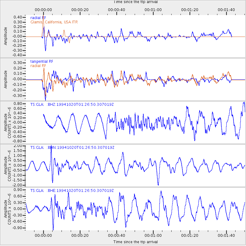
Signal To Noise
| Channel | StoN | STA | LTA |
| TS:GLA: :BHN:19941020T01:26:50.307019Z | 3.0853066 | 6.847308E-7 | 2.2193284E-7 |
| TS:GLA: :BHE:19941020T01:26:50.307019Z | 0.40110236 | 1.7360355E-7 | 4.3281608E-7 |
| TS:GLA: :BHZ:19941020T01:26:50.307019Z | 1.4876732 | 3.5629375E-7 | 2.3949733E-7 |
| Arrivals |
| Ps | |
| PpPs | |
| PsPs/PpSs | |


