You are here: Home > Network List > CI - Caltech Regional Seismic Network Stations List
> Station MPM Manuel Prospect Mine, California, USA > Earthquake Result Viewer
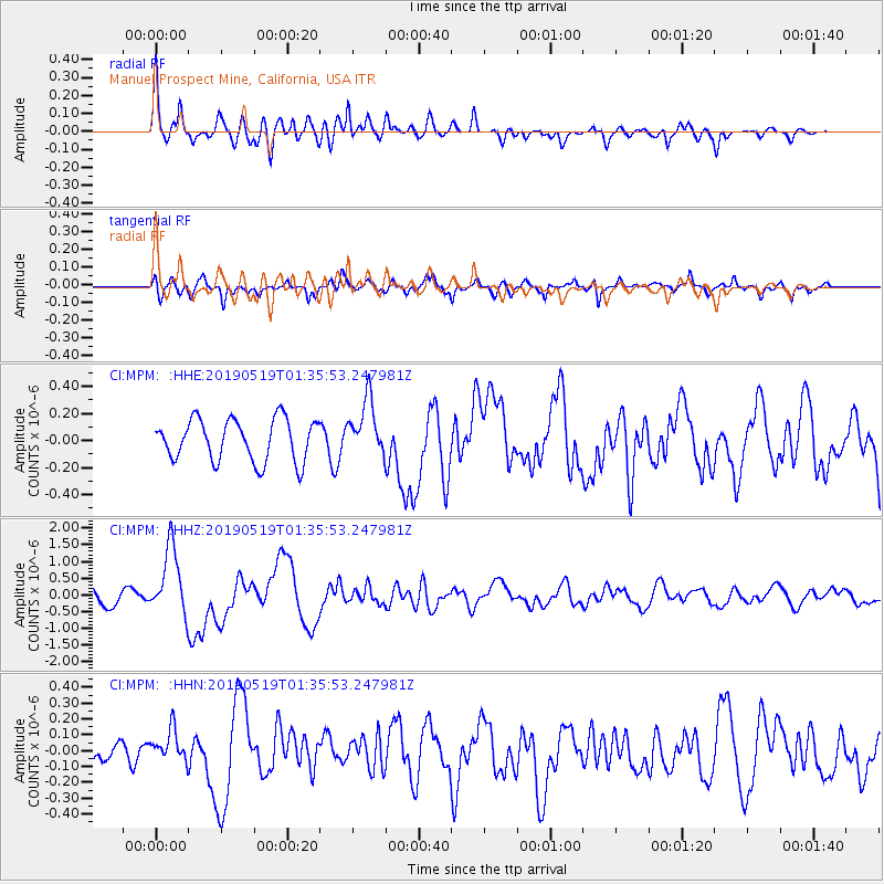
MPM Manuel Prospect Mine, California, USA - Earthquake Result Viewer
*The percent match for this event was below the threshold and hence no stack was calculated.
| Earthquake location: |
Southeast Of Loyalty Islands |
| Earthquake latitude/longitude: |
-21.7/169.8 |
| Earthquake time(UTC): |
2019/05/19 (139) 01:23:29 GMT |
| Earthquake Depth: |
20 km |
| Earthquake Magnitude: |
6.3 mww |
| Earthquake Catalog/Contributor: |
NEIC PDE/us |
|
| Network: |
CI Caltech Regional Seismic Network |
| Station: |
MPM Manuel Prospect Mine, California, USA |
| Lat/Lon: |
36.06 N/117.49 W |
| Elevation: |
185 m |
|
| Distance: |
89.5 deg |
| Az: |
50.687 deg |
| Baz: |
242.642 deg |
| Ray Param: |
$rayparam |
*The percent match for this event was below the threshold and hence was not used in the summary stack. |
|
| Radial Match: |
78.480675 % |
| Radial Bump: |
400 |
| Transverse Match: |
78.067696 % |
| Transverse Bump: |
400 |
| SOD ConfigId: |
18369291 |
| Insert Time: |
2019-06-02 01:26:03.696 +0000 |
| GWidth: |
2.5 |
| Max Bumps: |
400 |
| Tol: |
0.001 |
|
Signal To Noise
| Channel | StoN | STA | LTA |
| CI:MPM: :HHZ:20190519T01:35:53.247981Z | 4.4711714 | 1.0299362E-6 | 2.3035045E-7 |
| CI:MPM: :HHN:20190519T01:35:53.247981Z | 1.2802358 | 9.3843965E-8 | 7.33021E-8 |
| CI:MPM: :HHE:20190519T01:35:53.247981Z | 1.3398699 | 2.069743E-7 | 1.5447344E-7 |
| Arrivals |
| Ps | |
| PpPs | |
| PsPs/PpSs | |


