You are here: Home > Network List > TS - TERRAscope (Southern California Seismic Network) Stations List
> Station GLA Glamis, California, USA > Earthquake Result Viewer
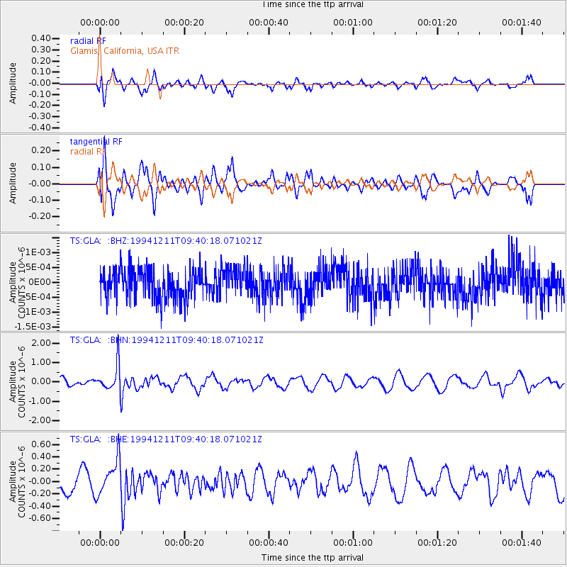
GLA Glamis, California, USA - Earthquake Result Viewer
*The percent match for this event was below the threshold and hence no stack was calculated.
| Earthquake location: |
South Of Fiji Islands |
| Earthquake latitude/longitude: |
-24.9/-179.1 |
| Earthquake time(UTC): |
1994/12/11 (345) 09:29:01 GMT |
| Earthquake Depth: |
391 km |
| Earthquake Magnitude: |
5.5 MB, 5.6 UNKNOWN |
| Earthquake Catalog/Contributor: |
WHDF/NEIC |
|
| Network: |
TS TERRAscope (Southern California Seismic Network) |
| Station: |
GLA Glamis, California, USA |
| Lat/Lon: |
33.05 N/114.83 W |
| Elevation: |
627 m |
|
| Distance: |
84.1 deg |
| Az: |
49.536 deg |
| Baz: |
235.357 deg |
| Ray Param: |
$rayparam |
*The percent match for this event was below the threshold and hence was not used in the summary stack. |
|
| Radial Match: |
63.61886 % |
| Radial Bump: |
400 |
| Transverse Match: |
63.61456 % |
| Transverse Bump: |
400 |
| SOD ConfigId: |
4480 |
| Insert Time: |
2010-02-26 14:13:30.484 +0000 |
| GWidth: |
2.5 |
| Max Bumps: |
400 |
| Tol: |
0.001 |
|
Signal To Noise
| Channel | StoN | STA | LTA |
| TS:GLA: :BHN:19941211T09:40:18.071021Z | 3.36594 | 7.111368E-7 | 2.1127435E-7 |
| TS:GLA: :BHE:19941211T09:40:18.071021Z | 2.2104955 | 2.9862352E-7 | 1.3509347E-7 |
| TS:GLA: :BHZ:19941211T09:40:18.071021Z | 0.95254195 | 4.61665E-10 | 4.846663E-10 |
| Arrivals |
| Ps | |
| PpPs | |
| PsPs/PpSs | |


