You are here: Home > Network List > TA - USArray Transportable Network (new EarthScope stations) Stations List
> Station D23K Nanushuk River, AK USA > Earthquake Result Viewer
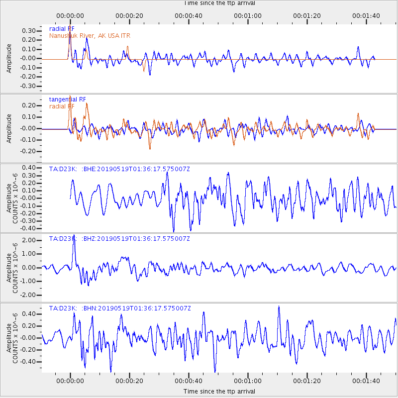
D23K Nanushuk River, AK USA - Earthquake Result Viewer
*The percent match for this event was below the threshold and hence no stack was calculated.
| Earthquake location: |
Southeast Of Loyalty Islands |
| Earthquake latitude/longitude: |
-21.7/169.8 |
| Earthquake time(UTC): |
2019/05/19 (139) 01:23:29 GMT |
| Earthquake Depth: |
20 km |
| Earthquake Magnitude: |
6.3 mww |
| Earthquake Catalog/Contributor: |
NEIC PDE/us |
|
| Network: |
TA USArray Transportable Network (new EarthScope stations) |
| Station: |
D23K Nanushuk River, AK USA |
| Lat/Lon: |
68.97 N/150.68 W |
| Elevation: |
406 m |
|
| Distance: |
94.8 deg |
| Az: |
13.328 deg |
| Baz: |
216.435 deg |
| Ray Param: |
$rayparam |
*The percent match for this event was below the threshold and hence was not used in the summary stack. |
|
| Radial Match: |
73.73698 % |
| Radial Bump: |
400 |
| Transverse Match: |
66.87149 % |
| Transverse Bump: |
400 |
| SOD ConfigId: |
18369291 |
| Insert Time: |
2019-06-02 01:28:27.381 +0000 |
| GWidth: |
2.5 |
| Max Bumps: |
400 |
| Tol: |
0.001 |
|
Signal To Noise
| Channel | StoN | STA | LTA |
| TA:D23K: :BHZ:20190519T01:36:17.575007Z | 4.760292 | 8.741901E-7 | 1.8364211E-7 |
| TA:D23K: :BHN:20190519T01:36:17.575007Z | 1.8658011 | 2.0718052E-7 | 1.11041054E-7 |
| TA:D23K: :BHE:20190519T01:36:17.575007Z | 1.5956181 | 1.7840743E-7 | 1.11810856E-7 |
| Arrivals |
| Ps | |
| PpPs | |
| PsPs/PpSs | |


