You are here: Home > Network List > TS - TERRAscope (Southern California Seismic Network) Stations List
> Station GLA Glamis, California, USA > Earthquake Result Viewer
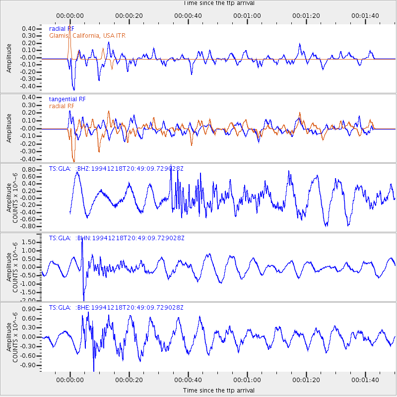
GLA Glamis, California, USA - Earthquake Result Viewer
*The percent match for this event was below the threshold and hence no stack was calculated.
| Earthquake location: |
Fiji Islands Region |
| Earthquake latitude/longitude: |
-17.9/-178.7 |
| Earthquake time(UTC): |
1994/12/18 (352) 20:38:32 GMT |
| Earthquake Depth: |
551 km |
| Earthquake Magnitude: |
5.6 MB, 5.8 UNKNOWN, 5.7 MW |
| Earthquake Catalog/Contributor: |
WHDF/NEIC |
|
| Network: |
TS TERRAscope (Southern California Seismic Network) |
| Station: |
GLA Glamis, California, USA |
| Lat/Lon: |
33.05 N/114.83 W |
| Elevation: |
627 m |
|
| Distance: |
79.2 deg |
| Az: |
50.129 deg |
| Baz: |
240.501 deg |
| Ray Param: |
$rayparam |
*The percent match for this event was below the threshold and hence was not used in the summary stack. |
|
| Radial Match: |
70.53527 % |
| Radial Bump: |
400 |
| Transverse Match: |
48.86791 % |
| Transverse Bump: |
400 |
| SOD ConfigId: |
4480 |
| Insert Time: |
2010-02-26 14:13:33.920 +0000 |
| GWidth: |
2.5 |
| Max Bumps: |
400 |
| Tol: |
0.001 |
|
Signal To Noise
| Channel | StoN | STA | LTA |
| TS:GLA: :BHN:19941218T20:49:09.729028Z | 2.5899186 | 7.1417986E-7 | 2.757538E-7 |
| TS:GLA: :BHE:19941218T20:49:09.729028Z | 1.4765303 | 3.1317956E-7 | 2.1210505E-7 |
| TS:GLA: :BHZ:19941218T20:49:09.729028Z | 0.94853854 | 2.764739E-7 | 2.9147355E-7 |
| Arrivals |
| Ps | |
| PpPs | |
| PsPs/PpSs | |


