You are here: Home > Network List > TA - USArray Transportable Network (new EarthScope stations) Stations List
> Station F26K Sheenjek River, AK, USA > Earthquake Result Viewer
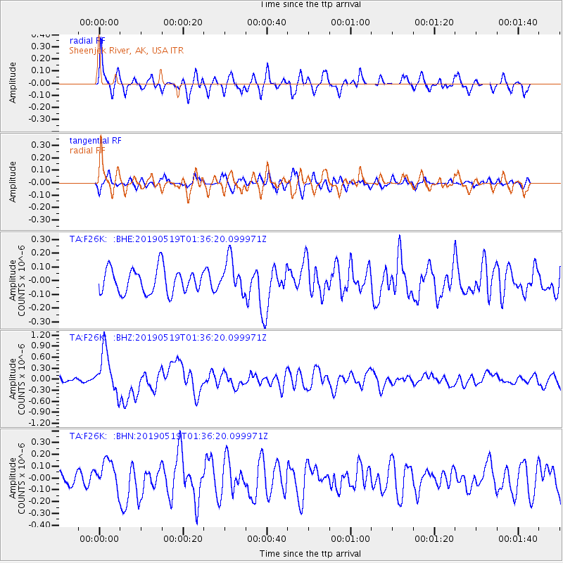
F26K Sheenjek River, AK, USA - Earthquake Result Viewer
*The percent match for this event was below the threshold and hence no stack was calculated.
| Earthquake location: |
Southeast Of Loyalty Islands |
| Earthquake latitude/longitude: |
-21.7/169.8 |
| Earthquake time(UTC): |
2019/05/19 (139) 01:23:29 GMT |
| Earthquake Depth: |
20 km |
| Earthquake Magnitude: |
6.3 mww |
| Earthquake Catalog/Contributor: |
NEIC PDE/us |
|
| Network: |
TA USArray Transportable Network (new EarthScope stations) |
| Station: |
F26K Sheenjek River, AK, USA |
| Lat/Lon: |
67.69 N/144.15 W |
| Elevation: |
683 m |
|
| Distance: |
95.3 deg |
| Az: |
16.023 deg |
| Baz: |
222.267 deg |
| Ray Param: |
$rayparam |
*The percent match for this event was below the threshold and hence was not used in the summary stack. |
|
| Radial Match: |
65.51916 % |
| Radial Bump: |
375 |
| Transverse Match: |
54.45019 % |
| Transverse Bump: |
400 |
| SOD ConfigId: |
18369291 |
| Insert Time: |
2019-06-02 01:28:41.753 +0000 |
| GWidth: |
2.5 |
| Max Bumps: |
400 |
| Tol: |
0.001 |
|
Signal To Noise
| Channel | StoN | STA | LTA |
| TA:F26K: :BHZ:20190519T01:36:20.099971Z | 5.6876945 | 5.9620396E-7 | 1.04823485E-7 |
| TA:F26K: :BHN:20190519T01:36:20.099971Z | 2.5142672 | 1.2851655E-7 | 5.111491E-8 |
| TA:F26K: :BHE:20190519T01:36:20.099971Z | 1.4544157 | 1.2680566E-7 | 8.718667E-8 |
| Arrivals |
| Ps | |
| PpPs | |
| PsPs/PpSs | |


