You are here: Home > Network List > TS - TERRAscope (Southern California Seismic Network) Stations List
> Station GLA Glamis, California, USA > Earthquake Result Viewer
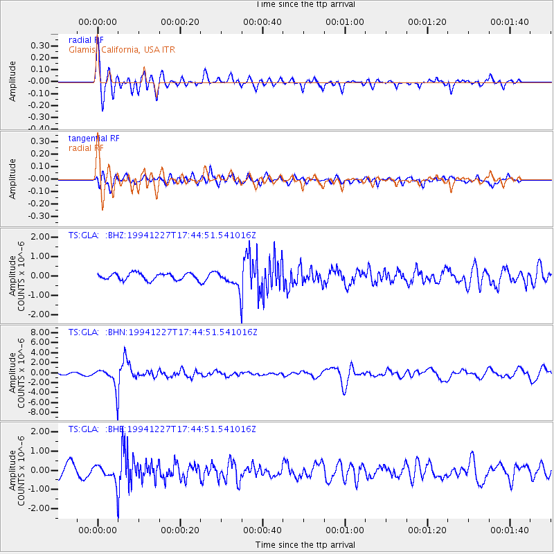
GLA Glamis, California, USA - Earthquake Result Viewer
*The percent match for this event was below the threshold and hence no stack was calculated.
| Earthquake location: |
South Of Kermadec Islands |
| Earthquake latitude/longitude: |
-32.0/179.9 |
| Earthquake time(UTC): |
1994/12/27 (361) 17:32:52 GMT |
| Earthquake Depth: |
228 km |
| Earthquake Magnitude: |
6.0 MB, 6.1 UNKNOWN, 6.4 MW |
| Earthquake Catalog/Contributor: |
WHDF/NEIC |
|
| Network: |
TS TERRAscope (Southern California Seismic Network) |
| Station: |
GLA Glamis, California, USA |
| Lat/Lon: |
33.05 N/114.83 W |
| Elevation: |
627 m |
|
| Distance: |
89.3 deg |
| Az: |
49.734 deg |
| Baz: |
230.527 deg |
| Ray Param: |
$rayparam |
*The percent match for this event was below the threshold and hence was not used in the summary stack. |
|
| Radial Match: |
74.15913 % |
| Radial Bump: |
400 |
| Transverse Match: |
63.67997 % |
| Transverse Bump: |
400 |
| SOD ConfigId: |
4480 |
| Insert Time: |
2010-02-26 14:13:34.434 +0000 |
| GWidth: |
2.5 |
| Max Bumps: |
400 |
| Tol: |
0.001 |
|
Signal To Noise
| Channel | StoN | STA | LTA |
| TS:GLA: :BHN:19941227T17:44:51.541016Z | 8.331534 | 2.38229E-6 | 2.8593652E-7 |
| TS:GLA: :BHE:19941227T17:44:51.541016Z | 1.1261939 | 5.268363E-7 | 4.6780247E-7 |
| TS:GLA: :BHZ:19941227T17:44:51.541016Z | 2.895772 | 4.943779E-7 | 1.7072402E-7 |
| Arrivals |
| Ps | |
| PpPs | |
| PsPs/PpSs | |


